UAV Lidar data Results

UAV Lidar data Results

m

March 19, 2021

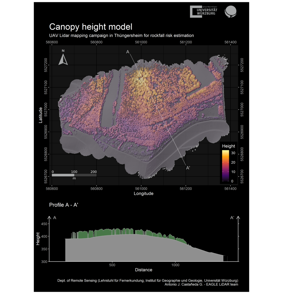
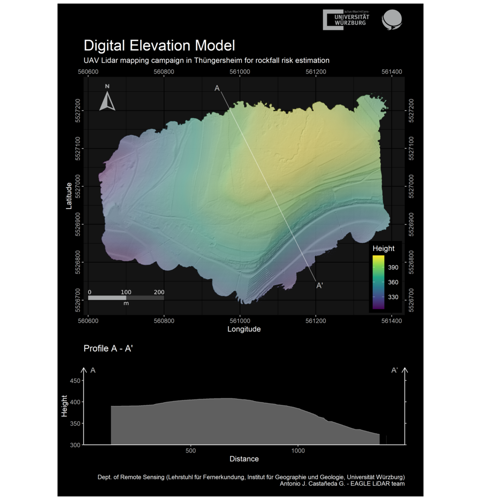
Our first results of UAV based Lidar analysis are very valuable for the georisk analysis of rock fall close to Würzburg in Thüngersheim in cooperation with our soil science colleagues. Further analysis based on UAV sensors will be multispectral and thermal analysis of soil and vegetation conditions and changes. Additional sites will be monitored soon for more georisk and forest structure in the Würzburg area, in Bavarian Nationalparks and in collaboration with different colleagues from various disciplines.

follow us and share it on:

you may also like:

EO4CAM at Tag der Hydrologie 2026 in Kassel

EO4CAM at Tag der Hydrologie 2026 in Kassel

From March 4–6, 2026, Sofia Haag from the EO4CAM project attended the Tag der Hydrologie conference in Kassel. Held under the theme “Water resources under pressure,” the conference brought together researchers and practitioners to discuss current challenges and...

“Where Is Everybody?” — The EO4CAM Effect

“Where Is Everybody?” — The EO4CAM Effect

If you walked through the corridors of our EORC offices this week, you might have had the same thought as many confused colleagues: “Where is everybody?” Yes, we know the meme. But before you assume a mysterious disappearance, spontaneous field campaign, or a secret...

Share This