UAV Lidar mapping for rockfall Risk Estimation

UAV Lidar mapping for rockfall Risk Estimation

m

March 5, 2021

The area of the rockfall event above vineyards within a nature protection zone

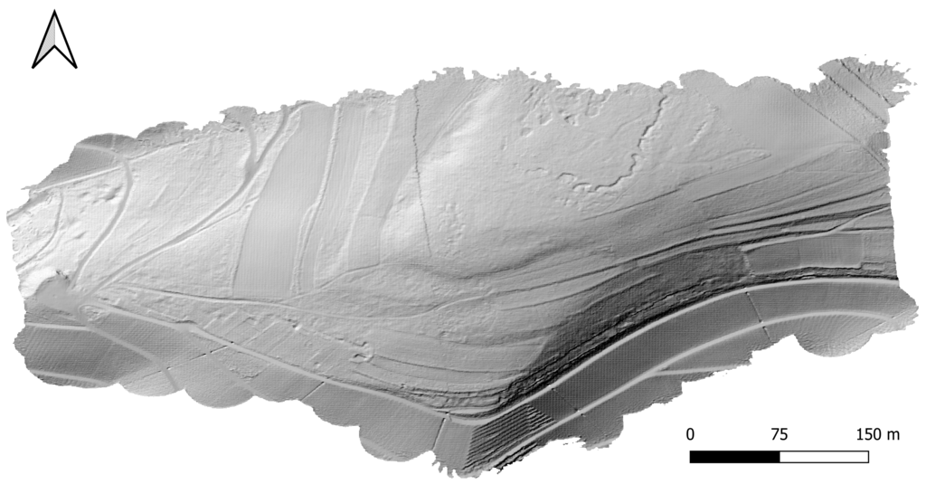
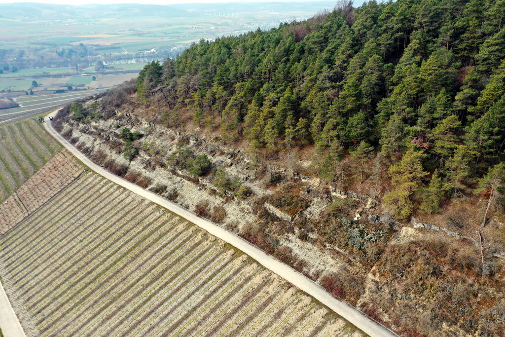
Due to a recent rockfall event and in order to analyze the landscape conditions within this area did we conduct a UAV Lidar mapping campaign in Thüngersheim, close to Würzburg. The main aim was to retrieve necessary environmental information about this specific area in very high spatial resolution to understand the causes of this rockfall and the potential future developments. In collaboration with soil scientists from the University of Würzburg our UAV data does contribute to the rockfall risk estimation.

We covered the larger area with large research UAVs carrying a Lidar sensor that allows to retrieve ground level information as well as the height of the vegetation.

Further information will be acquired in the next days in order to gain more insights into the landscape conditions.

Actual surface properties without vegetation cover is retrieved. The detailed soil properties can be clearly distinguished.

you may also like:

Public talk about climate change in Africa

Public talk about climate change in Africa

What are the effects of climate change on Africa? Our colleague Michael Thiel delved into this pressing question during a public lecture on Tuesday, February 11th, at the Weltladen in Würzburg. In an intimate and engaging setting, Mr. Thiel discussed the multifaceted...

New publication on time-series web application

New publication on time-series web application

Our PhD student Luisa Pflumm published an article on "GEE-PICX: generating cloud-free Sentinel-2 and Landsat image composites and spectral indices for custom areas and time frames – a Google Earth Engine web application." in Ecography. Check out the contente here from...