Workshop Report at the Department of Remote Sensing – January 27, 2021

Workshop Report at the Department of Remote Sensing – January 27, 2021

m

January 11, 2021

We are glad to announce our first workshop report at the Department of Remote Sensing in 2021! On 27th of January, the EAGLE master students Sofía Garcia, Annika Ludwig, Antonio Castañeda, Nils Karges, and Andreas Bury will talk about A multi-sensor approach for environmental monitoring combining IoT and remote sensing in a cloud-based Wireless Sensor Network (WSN)”.

Abstract

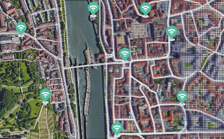
The recent advancements in the IoT (Internet of Things) present an enormous potential for improving the monitoring of essential environmental variables. Sensors and microcontrollers offer an efficient solution for collecting in-situ data of temperature, humidity, UV radiation, particulate matter (PM1, PM 2.5, PM 10), and soil moisture. These measurements can be used for a wide range of applications such as monitoring the relationship between urban green and temperature, identifying air pollution hotspots, or supporting the downscaling of satellite remote sensing (RS) products. Satellite and UAV-based RS and IoT are essentially complementary methods to generate data and analytics. Both techniques enable efficient monitoring on a large scale and in a high spatiotemporal resolution. IoT devices collect data of specific locations and transport it using wireless network protocols like MQTT. Next, it is stored in cloud-based database management systems. The post-processing includes data cleaning and validation, normalization, temporal and spatial smoothing, and data analysis to determine trends. Finally, users can access, visualize, or download data using application software or APIs. Our project aims to test low-cost Arduino-based sensors in an urban field of application (city of Würzburg) and correlate in-situ data with relevant RS-based parameters. Eventually, we aim at gaining a better knowledge of the atmosphere and the land surface dynamics.

Title of presentation: A multi-sensor approach for environmental monitoring combining IoT and remote sensing in a cloud-based Wireless Sensor Network (WSN) Presenters: Sofía Garcia, Annika Ludwig, Antonio Castañeda, Nils Karges, and Andreas Bury (all EAGLE Graduate Program (M.Sc.), Department of Remote Sensing, University of Würzburg)

Date: Wednesday, 27th of January, 2021 Time: 10 – 11 am s.t. Place: Online Presentation language: English Slides: English

follow us and share it on:

you may also like:

Drone manufacturer Wingtra visits EORC

Drone manufacturer Wingtra visits EORC

Is it possible to combine the efficiency of a fixed-wing drone with the precision of a laser scanner? That question brought researchers from EORC together with Wingtra, a Swiss company designing and manufacturing fixed-wing UAS, to exchange on UAS research and discuss...

How We Learned to Fly: The Story Behind UAS Research at EORC

How We Learned to Fly: The Story Behind UAS Research at EORC

Every research group that's ever bought a drone has a story about the first one it lost. We're no different. So let's just get that out of the way up front: this is the inside story of how UAS (Unoccupied Aerial System) research grew up at the Earth Observation...

MainPro workshop on TLS and LiDAR UAS

MainPro workshop on TLS and LiDAR UAS

This week, a workshop organized by Sebastian Buchelt within our EFRE project MainPro brought together students, researchers, and interested project partners to explore modern UAV technologies. The workshop took place in vineyards close to Würzburg and gave the...

25 Years of Remote Sensing in Würzburg

25 Years of Remote Sensing in Würzburg

Our chair of remote sensing, Professor Stefan Dech, likes to say "science is rarely a sprint, it's a marathon". And if you look at what's grown out of Würzburg over the last 25 years, you'll see exactly what he means. In 2026 the Julius-Maximilians-Universität...

Starkregen in Bayern: Beobachtungen und Dokumentation zählen

Starkregen in Bayern: Beobachtungen und Dokumentation zählen

Starkregenereignisse treten immer häufiger lokal, kurzfristig und mit hoher Intensität auf. Innerhalb weniger Stunden können sie erhebliche Überschwemmungen und Schäden verursachen. Um solche Ereignisse künftig besser zu verstehen und die wissenschaftliche Grundlage...

Seeing the World in Points: Lidar Course for the EAGLEs

Seeing the World in Points: Lidar Course for the EAGLEs

Lidar has a funny way of sneaking up on you. You think you know what it is, a laser that measures distance, fine, but then someone shows you a point cloud of a forest canopy with individual branches floating in 3D space and suddenly you realize there's a whole...

Share This