CODE-DE – Satellite data free of charge for everyone

CODE-DE – Satellite data free of charge for everyone

March 27, 2017

Our colleagues at DLR released a platform which allows easy and free of charge access to Sentinel remote sensing data:

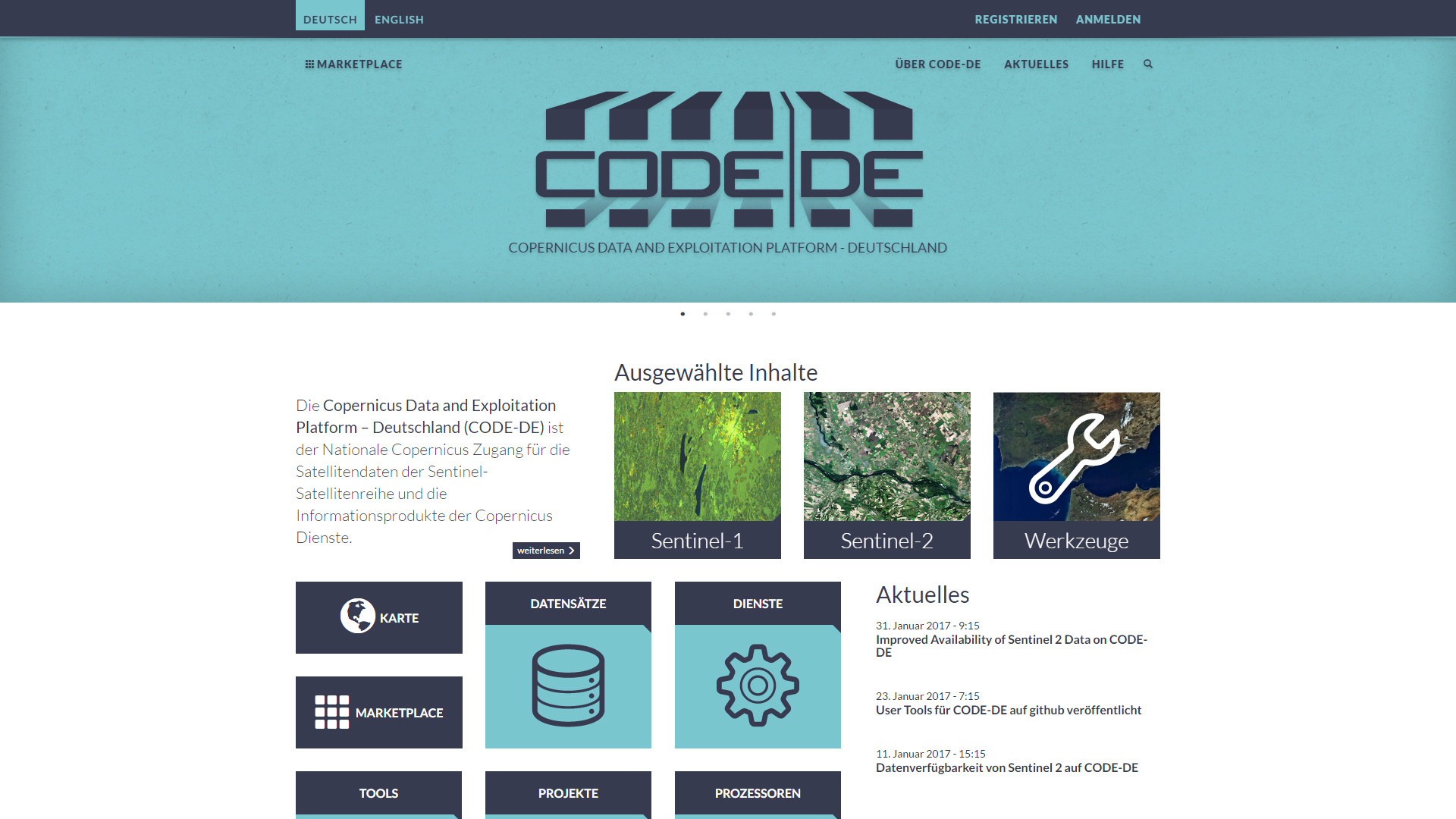
CODE-DE makes possible free-of-charge, simple access to data from the Sentinel satellites and to information products from the European Copernicus programme–including an up-to-date cloud-free mosaic of Germany, produced at EOC. The platform will also provide access to national geodata infrastructure (GDI-DE). This portal provides harmonised and standardised German geodata from a wide variety of sources. By agreement with industrial partners it is also planned to offer data from the German radar satellites TerraSAR-X and TanDEM-X as well as high-resolution optical images from RapidEye satellites.

CODE-DE offers a one-stop shop. The data is collected in a single portal so that users no longer have to search through various databases, as formerly. This gives them direct access to an enormous amount of data—the Sentinel satellites alone will produce a data volume of some 50 petabytes by the end of 2020.


read more: http://www.dlr.de/eoc/en/desktopdefault.aspx/tabid-11932/20674_read-48811/


follow us and share it on:

you may also like:

Henri Debray Successfully Defends PhD on Global Urban Morphology

Henri Debray Successfully Defends PhD on Global Urban Morphology

We are delighted to announce that our PhD student Henri Debray has successfully defended his doctoral thesis, “Characterizing Urban Morphology at a Global Scale: Geospatial Perspectives,” at the Technical University of Munich, where his research project was conducted....

Dr. Simon Plank interviewed by NASA Earth Observatory

Dr. Simon Plank interviewed by NASA Earth Observatory

Home Reef, which is part of the Tonga Volcanic Arc, is the youngest volcanic island on Earth. Dr. Simon Plank, our habilitation candidate and guest lecturer from DLR, has been monitoring the evolution of Home Reef since the island emerged above sea level in September...

EOCap4Africa Training in Kinshasa

EOCap4Africa Training in Kinshasa

This week, 14 students are attending a test run of our Remote Sensing module on Remote Sensing for Biodiversity Conservation at the University of Kinshasa. This module is part of the EOCap4Africa project (funded by the Federal Agency for Nature Conservation, lead Dr....

KI4Stereo – Hybrid kick-off meeting at DLR

KI4Stereo – Hybrid kick-off meeting at DLR

KI4Stereo – Hybrid kick-off meeting at DLR: AI-based analysis of stereo image data for tree monitoringOn January 23rd, 2026, a hybrid kick-off meeting was held at DLR to officially launch the research project KI4Stereo (funded under the KMU-innovativ programme,...

Share This