innovative urban climate in-situ measurements for Earth Observation

innovative urban climate in-situ measurements for Earth Observation

February 10, 2021

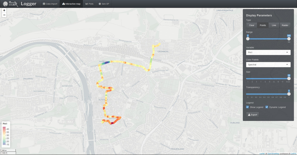
Bikair is a project aiming at measuring urban climate parameters with in-situ and Earth Observation. It focuses on testing low-cost Arduino-based sensors in an urban environment such as the city of Würzburg. Eventually, the project aims to correlate in-situ data with relevant Remote Sensing-based parameters. It takes advantage of the recent advancements in the Internet of Things (IoT), which allows the collection of data on specific locations and its further transportation using wireless network protocols. Bikair team designed static and mobile devices using sensors that measure environmental parameters like temperature, humidity, UV radiation, particulate matter (PM1, PM 2.5, PM 10), and soil moisture. Through microcontrollers and communication protocols, the data is stored in cloud-based database management systems, and it is analyzed to determine trends. The final product would allow users to access, visualize, or download the data using application software or APIs. These measurements could strengthen a wide range of applications such as monitoring the relationship between urban green and temperature, identifying air pollution hotspots, or supporting the downscaling of satellite remote sensing products.

follow us and share it on:

you may also like:

How We Learned to Fly: The Story Behind UAS Research at EORC

How We Learned to Fly: The Story Behind UAS Research at EORC

Every research group that's ever bought a drone has a story about the first one it lost. We're no different. So let's just get that out of the way up front: this is the inside story of how UAS (Unoccupied Aerial System) research grew up at the Earth Observation...

MainPro workshop on TLS and LiDAR UAS

MainPro workshop on TLS and LiDAR UAS

This week, a workshop organized by Sebastian Buchelt within our EFRE project MainPro brought together students, researchers, and interested project partners to explore modern UAV technologies. The workshop took place in vineyards close to Würzburg and gave the...

25 Years of Remote Sensing in Würzburg

25 Years of Remote Sensing in Würzburg

Our chair of remote sensing, Professor Stefan Dech, likes to say "science is rarely a sprint, it's a marathon". And if you look at what's grown out of Würzburg over the last 25 years, you'll see exactly what he means. In 2026 the Julius-Maximilians-Universität...

Starkregen in Bayern: Beobachtungen und Dokumentation zählen

Starkregen in Bayern: Beobachtungen und Dokumentation zählen

Starkregenereignisse treten immer häufiger lokal, kurzfristig und mit hoher Intensität auf. Innerhalb weniger Stunden können sie erhebliche Überschwemmungen und Schäden verursachen. Um solche Ereignisse künftig besser zu verstehen und die wissenschaftliche Grundlage...

Seeing the World in Points: Lidar Course for the EAGLEs

Seeing the World in Points: Lidar Course for the EAGLEs

Lidar has a funny way of sneaking up on you. You think you know what it is, a laser that measures distance, fine, but then someone shows you a point cloud of a forest canopy with individual branches floating in 3D space and suddenly you realize there's a whole...

TV Crew Films EORC at MONID Habitrack Fieldwork

TV Crew Films EORC at MONID Habitrack Fieldwork

A bit of extra excitement at EORC recently: A television crew showed up to film a segment on the MONID Habitrack project financed by the BMFTR, and Dr. Ariane Droin was right in the middle of it, walking them through what Earth...

Share This