

Recently, the M.Sc student Bastian Schumann applied for a 3-month sull license of LAStools to be applied in the course of his M.Sc thesis “Explaining over- and understory canopy coved by leaf-off and leaf-on LiDAR data”. LAStools consists of highly efficient, batch-scriptable, multicore command line tools to classify, tile, convert, filter, raster, triangulate, contour, clip, and polygonize LiDAR data. By submitting an appllication supported by a proposal, limited number of underfunded academics who have no budget for a full academic LAStools license qualify for a few LASmoons of full LAStools functionality. These complimentary licenses typically last three full months.
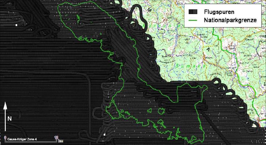
Example of LiDAR flight strips over the entire Bavarian Forest National Park
Supervised by Dr. Hooman Latifi from Dept. of remote sensing in Würzburg, Bastian Schumann will extract statistical and density metrics from two sets of leaf-off and leaf-on LiDAR data to make an accurate and unbiased estimation of canopy density in tree, shrub and herbal layers within the Bavarian Forest National Park. LAStools will be used here to initially process the raw point cloud data and create DTMs, DSMs and CHMs and to derive LiDAR metrics from normalized LiDAR points. The full version of LAStools is needed to assure timely processing of the vast amount of raw data.The results of this study will be used as a benchmark to compare with those previously achieved by Latifi et al. (2015) using leaf-on data across the same study area.
Further informaiton on this project can be found in the LASmoons blog which will also cover further updates on the opurtcomes of this work.


