Remote Sensing Training for Professionals

Remote Sensing Training for Professionals

m

June 1, 2021

A remote sensing and GIS training for professional development aid staff members was conducted last month. Within 5 days the participants learned the basics of spatial data handling, creating maps, acquiring remote sensing data and earth observation products up to doing first steps in GoogleEarthEngine. The practical desktop exercises were done using QGIS and its powerful expression functions and geometry generators. Despite the challenging situation did we receive quite positive feedback about our virtual training but of course we are looking forward to do in-person trainings again once the are allowed.
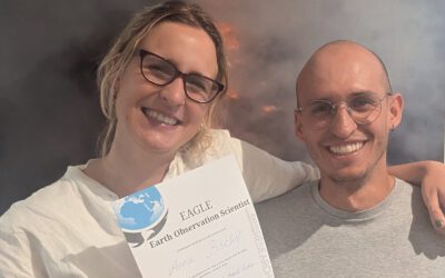
you may also like:

Super-Test-Site Würzburg meeting

Super-Test-Site Würzburg meeting

The team of our "Super-Test-Site Würzburg" consortium (University of Würzburg, the Karlsruhe Institute of Technology, the Friedrich-Alexander-University Erlangen-Nürnberg, Leibniz-Institute for Länderkunde in Leipzig  and the German Aerospace Center)...

A Warm and Festive Evening: The EORC Christmas Party

A Warm and Festive Evening: The EORC Christmas Party

As the year slowly draws to a close, the EORC came together this week to celebrate the season and spend an evening away from our usual desks, and classrooms. Our annual EORC Christmas Party brought together staff members, student assistants, and our current MSc...

Ideas and Inspiration: Our Internship & MSc Thesis Fair

Ideas and Inspiration: Our Internship & MSc Thesis Fair

This week we hosted our annual EORC Internship and MSc Thesis Fair, bringing together our research staff and the current cohort of EAGLE students. As always, the event offered a relaxed and welcoming atmosphere—an ideal setting for exploring future academic pathways....

Presenting Our UAS Research at the UFS Science Team Meeting

Presenting Our UAS Research at the UFS Science Team Meeting

At the recent UFS (Umweltforschungsstation Schneefernerhaus) science team meeting, our group had the opportunity to present current and planned UAS-based research activities in the high-mountain environment surrounding the Zugspitze. The meeting offered an ideal...

Share This