Our chair of remote sensing, Professor Stefan Dech, likes to say “science is rarely a sprint, it’s a marathon”. And if you look at what’s grown out of Würzburg over the last 25 years, you’ll see exactly what he means.
In 2026 the Julius-Maximilians-Universität Würzburg celebrates a quarter century of remote sensing research and teaching. It all started in 2001, when Stefan Dech took up his professorship here. Nobody could have predicted back then that this would grow into what we now call the Earth Observation Research Cluster, or EORC for short, the joint effort between Stefan Dech’s and Hannes Taubenböck’s departments. Today it’s a place where space-borne, air-borne and UAS-based Earth observation meet geoinformatics, social and environmental sciences, all wrapped up in spatial science and applied to more fields than we could have imagined at the start.
None of this would have happened without German Aerospace Center (DLR). The DLR’s Earth Observation Center has been the constituting partner from beginning on, and that’s what makes Würzburg special. Big-scale DLR research and university research feed into each other here, in ways that push academic work, technological development, and real-world application forward at the same time.
So where does that leave us today? Around 40 researchers and staff, plus 80 MSc students, all under the EORC umbrella. That includes the Chair of Remote Sensing under Stefan Dech, the Chair of Global Urbanization and Remote Sensing under Hannes Taubenböck, and the professorships of Tobias Ullmann and Claudia Künzer, with Martin Wegmann holding it all together as Managing Director.
Twenty-five years is a long time in a field like ours. Satellites have gotten dramatically more capable, drones and airborne systems have become everyday tools rather than novelties, and computing power has completely rewritten how we process and analyse environmental data. And the questions we ask have grown right along with the tools.
These days, research at EORC stretches from the nuts and bolts of Earth observation data science all the way to climate change, biodiversity, urban studies, agriculture, disaster risk, and environmental management. We’re not just sitting in one kind of landscape either, our studies take us from Bavarian farmland and European cities to tropical forests, African savannahs, high mountains, and Arctic permafrost.
What really defines the way we work, though, is mixing scales and data sources. Satellite imagery is still the backbone, sure, but it’s joined by airborne data, drone footage, field measurements (everything from snow depth to bike-mounted sensors), social media data, and all sorts of other geospatial sources. Put that together and you can trace environmental and societal change from a single street to the entire globe.
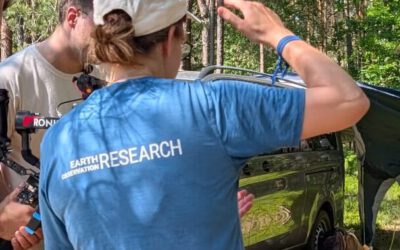
Teaching has been just as central to this story as the research itself. The EAGLE Master’s programme, Applied Earth Observation and Geoanalysis of the Living Environment, has turned into a highly successful EO programme. Students have come here from all corners of the world, studied, done fieldwork, lived in Würzburg, and built a genuinely international community that keeps shaping the field long after they’ve moved on.
And international ties run deep here in general. Through research partnerships, exchanges, field campaigns and capacity-building work, EORC stays connected to institutions across Europe, Africa, Asia, and the Americas. Those connections aren’t just good for science either, plenty of them have turned into lasting friendships and professional relationships that span decades.
A 25th anniversary is a good opportunity to look back and say thank you. We owe a lot to Stefan Dech, whose vision turned remote sensing into a major field here in Würzburg, and whose open-mindedness left room for new ideas, new directions, and new collaborations to take root. The same goes for our colleagues at DLR, without whom none of this would have come together the way it did. Finally, we would like to thank the University of Würzburg for providing the environment, trust, and support that have enabled us to grow and thrive over the past 25 years.
This anniversary is ultimately about the many researchers, technical staff, administrators, students, alumni, and partners who have shaped EORC over the past 25 years. Their work and commitment are what made the centre what it is today. That is what we will celebrate on July 16th!
The challenges ahead will continue to evolve, and so will Earth observation. With new technologies, new methods, and strong collaborations, we look forward to the next chapter of EORC in Würzburg.