
Mapping Lava Tubes on Mauritius with iPhone Pro LiDAR

Mapping Lava Tubes on Mauritius with iPhone Pro LiDAR

July 31, 2026

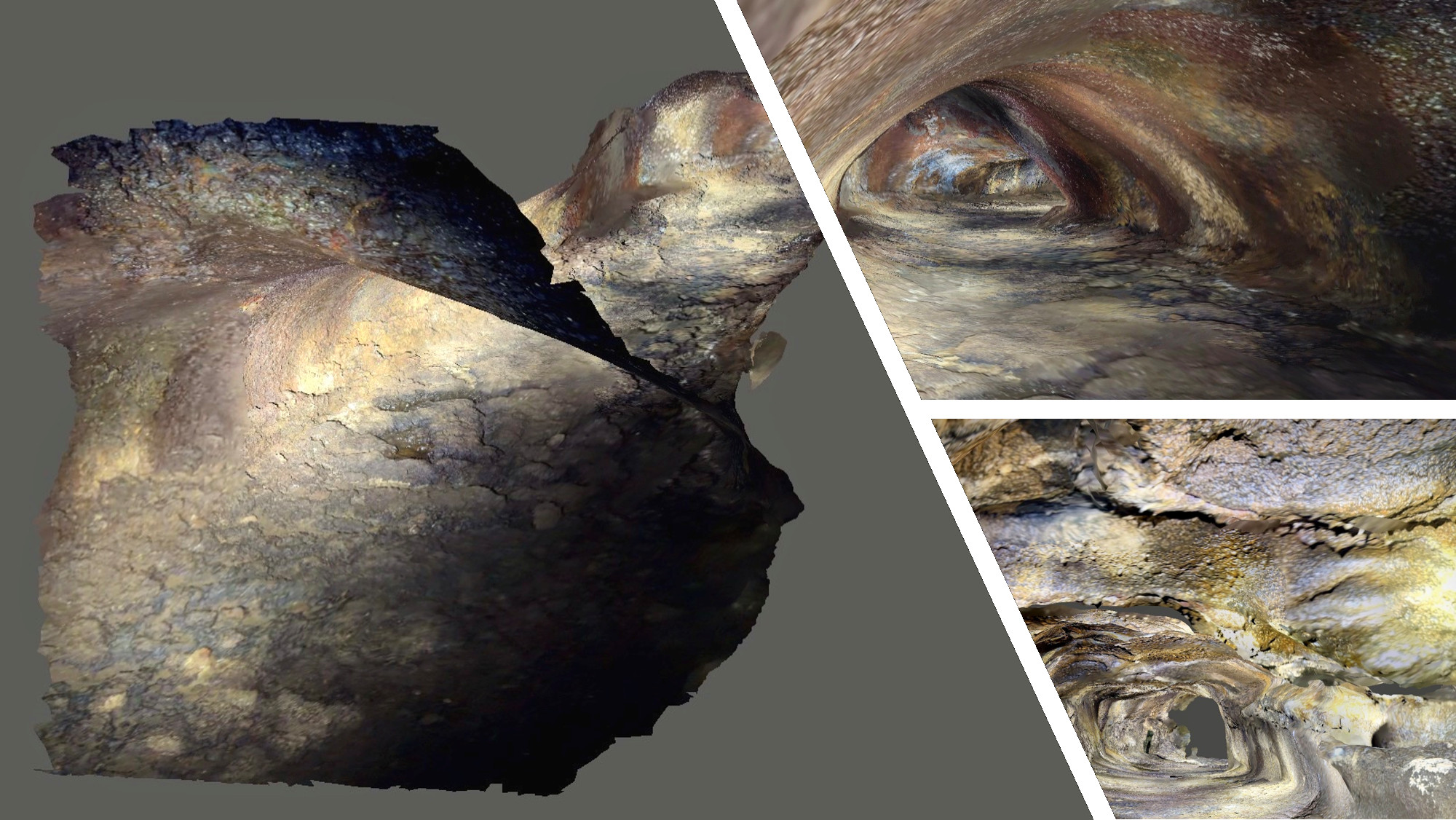
Lava tube structures on Mauritius are quite hard to survey – tight, dark, and largely inaccessible to classical scanning equipment. As part of ongoing research by Dr. Kim Lea Holzmann (Chair of Animal Ecology and Tropical Biology, University of Würzburg), we’re excited to be collaborating on testing whether low-cost LiDAR-scanners, like the recent iPhone Pro models, can offer a fast, lightweight way to capture the 3D geometry of these cave systems.


Ahead of fieldwork, we ran test scans together with Dr. Julia Rieder to adapt our usual scanning technique to confined, low-light cave conditions. Early results are promising: despite its modest range, the iPhone’s LiDAR sensor captures coherent tunnel geometry – with a device that fits in your pocket.


We’re looking forward to supporting this project further and sharing more results soon!


follow us and share it on:

you may also like:

Würzburger Förderpreis awarded to our URBAN:Pulse project

Würzburger Förderpreis awarded to our URBAN:Pulse project

“A remote sensing scientist, a social geographer, an informatics researcher, a sports researcher, a psychologist, a linguist and an economist meet ... what sounds like the start of a joke, was the start of a great interdisciplinary research project.” That’s how Hannes...

Annual Meeting of the NetCDA consortium

Annual Meeting of the NetCDA consortium

On November 3-4, 2026, the NetCDA II (European Academic Network for Capacity Development in Climate Change Adaptions in Africa) project network of 12 German academic partners met at the EORC for their annual meeting. We welcomed our new German research institutions on...

GLS-team visits Planetary Health exhibition

GLS-team visits Planetary Health exhibition

One of the aims of Geolingual Studies Geolingual Studies - Geolingual Studies is to ensure effective science communication beyond the scientific community and into the wider society. The Geolingual Studies team was given the opportunity to look at concepts and methods...

bzgl. Art. 50 Verordnung (EU) 2024/1689 (AI Act):

Überwiegend werden eigene originäre Texte und Bilder des EORC genutzt, jedoch sind einige Inhalte von blog post Texten teilweise mit Hilfe von KI überarbeitet worden und einige Bilder sind ganz mit KI erstellt, die jedoch deutlich keine photorealistische Darstellungen abbilden. Aussnahmen sind KI generierte fernerkundliche Datensätze, die explizit für Forschungszwecke mit KI erstellt wurden, hier wird aber durch den assoziierten Text der wissenschaftliche Grund der KI generierten Bilder erläutert.

Share This