
A new paper from our Geolingual Studies research has been published as chapter in a new book titled “Developments in Geospatial information Sciences”. The chapter is titled “Can Social Media Data Help to Understand the Socio-spatial Heterogeneity of the Interests and Concerns of Urban Citizens? A Twitter Data Assessment for Mexico City” and has been published by Richard Lemoine-Rodríguez, Carolin Biewer, and Hannes Taubenböck. The work is funded by the Volkswagen Foundation provided through the “A New Focus in English Linguistics: Geolingual Studies” project (grant number 98 662).
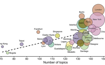
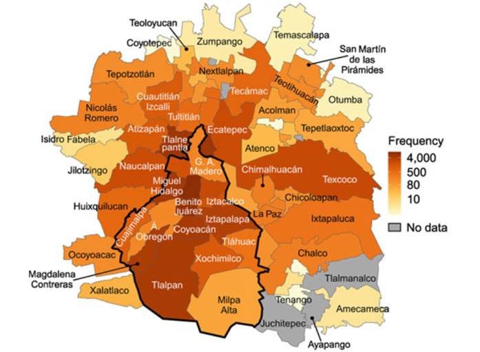
Here is the abstract of the paper: Identifying and geolocating the diverse, even contrasting interests, needs and concerns of highly heterogeneous urban populations is challenging. In this research, we used social media (i.e., Twitter) and census data to assess the topics discussed by the inhabitants of the continuous urban area of Mexico City, Mexico and its surroundings around the 2021–2022 New Year’s Eve period. We applied bot filters and undertook text cleaning to control the reliability of our data. Furthermore, we implemented topic modeling to identify the themes discussed. Finally, we assessed the relationship between Twitter activity and content and total population and marginalization at the municipality scale. Socially and environmentally relevant topics such as LGBTQ+, politics, vaccinations, women/feminism, air transport, cycling, healthcare/medicine, and public transportation were present in the digital urban conversation. People who are more marginalized displayed lower activity on Twitter and less diversity of topics. Moreover, there is high spatial clustering between the main topics discussed at the municipality level. Topics such as vaccinations, reading/literature and computers/smartphones are mainly discussed in areas with low marginalization, while racism/race, public transportation and money/finance are frequent in municipalities with a high proportion of marginalized inhabitants. Our results show the plausibility of the use of social media data to identify and geolocate the diverse interests and concerns of urban citizens based on first-hand information. Moreover, this approach may provide insights for decision making for urban policies, informing on location-specific social and environmental issues related to particular social groups.
Please find the link to the book here: https://link.springer.com/book/10.1007/978-3-031-61440-8
Please find other research papers from Geolingual Studies here:
- https://www.sciencedirect.com/science/article/pii/S030645732400030X
- https://onlinelibrary.wiley.com/doi/10.1002/psp.2732
- https://www.mdpi.com/2220-9964/12/4/175