
Paper on “Comparing Geospatiality of Topics ” published through the GeoExT Workshop

Paper on “Comparing Geospatiality of Topics ” published through the GeoExT Workshop

May 29, 2025

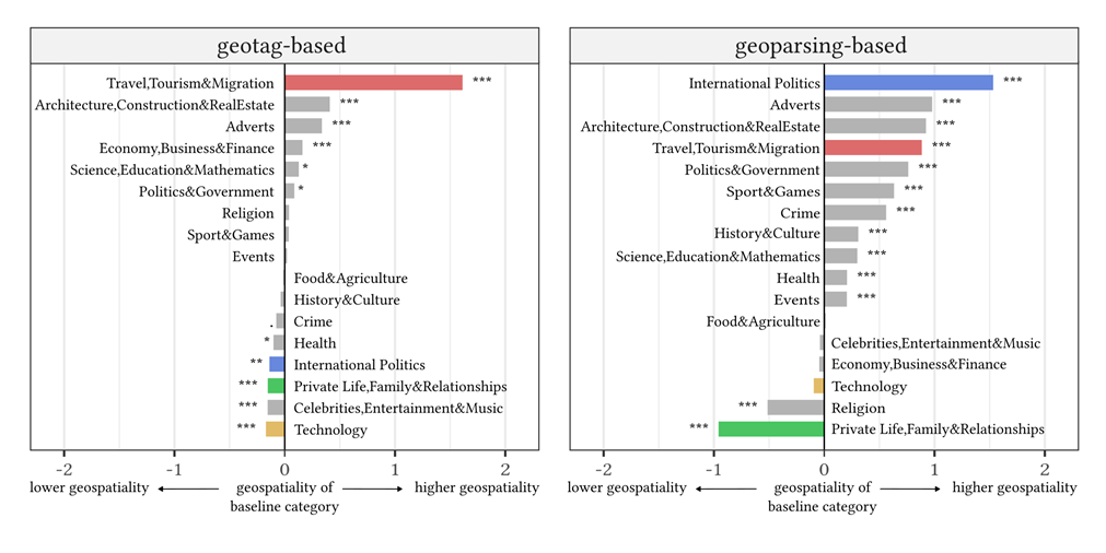
Our team of researchers from the Earth Observation Center (EOC) of the German Aerospace Center (DLR), our Earth Observation Research Cluster (EORC) and the Geolingual Studies team of the University of Würzburg published a new study in which we continue our studies on Geospatiality. The paper is titled “Comparing Geospatiality of Topics between Geotag- and Geoparsing-based Geolocations“.

Previously, we had found that the topic of a text influences how likely it is to mention a location (that makes it usable for spatial studies). In this new study, we analyzed whether a similar relationship also exists for geotags set by the user. As it turns out, it does: The topic of a Tweet is significantly related to the likelihood of it being geotagged. Overall, the effect on geotags is weaker than for location mentions, however, there are some notable exceptions, like the topic of Travel, Tourism, and Migration. Identifying such biases in geospatial text data allows us to account for them when we attempt to harness the rich information that web texts can provide for spatial studies.


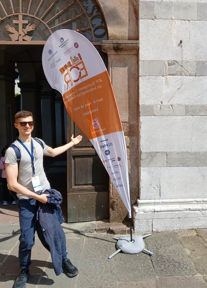
This study was presented by Johannes Mast last month at the International Workshop on Geographic Information Extraction from Texts (GeoExT) in Lucca, Italy and the full text is now publicly available at: https://ceur-ws.org/Vol-3969/paper1.pdf  


The work supports our research initiative ‘Geolingual Studies’, which jointly applies spatial and linguistic approaches in geographic studies, and OpenSearch@DLR, which aims at providing free and transparent access to web information for research.


For some examples of the spatial analysis of text data, see:

The migrant perspective: Measuring migrants’ movements and interests using geolocated tweets

The voices of the displaced: Mobility and Twitter conversations of migrants of Ukraine in 2022


follow us and share it on:

you may also like:

Remote Sensing for Germany #2

Remote Sensing for Germany #2

Last year, we gave an overview of our remote sensing work on environmental issues having a special focus on Germany – https://remote-sensing.org/remote-sensing-for-germany-1/ . To follow on from this, we present today a selection of studies on spatial patterns...

Simon Plank gives a talk at GZS-Seminar at EOC of DLR

Simon Plank gives a talk at GZS-Seminar at EOC of DLR

On October 22, our habilitation candidate and guest lecturer from DLR, Dr. Simon Plank gave an inspiring talk at the seminar of the department "Georisks and Civil Security (GZS)" at the Earth Observation Center (EOC) of the German Aerospace Center (DLR). The talk was...

New paper ‘From Spatial to Platial Decision Support’ published

New paper ‘From Spatial to Platial Decision Support’ published

Three  years ago, at the Geolingual Studies Workshop (see here: https://remote-sensing.org/geolingual-studies-workshop-day-1/) researchers from very different disciplines developed ideas to explore how we can better understand the relationship between people and urban...

bzgl. Art. 50 Verordnung (EU) 2024/1689 (AI Act):

Überwiegend werden eigene originäre Texte und Bilder des EORC genutzt, jedoch sind einige Inhalte von blog post Texten teilweise mit Hilfe von KI überarbeitet worden und einige Bilder sind ganz mit KI erstellt, die jedoch deutlich keine photorealistische Darstellungen abbilden. Aussnahmen sind KI generierte fernerkundliche Datensätze, die explizit für Forschungszwecke mit KI erstellt wurden, hier wird aber durch den assoziierten Text der wissenschaftliche Grund der KI generierten Bilder erläutert.

Share This