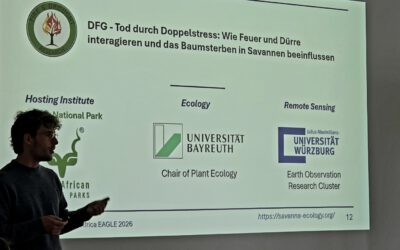
Amidst the vast and dynamic landscapes of the African savannas, our dedicated PhD students, Luisa Pflumm and Konstantin Müller, are currently embarking on an extensive research mission. Together with Dr. Mirjana Bevanda, they are conducting environmental research using means of UAS/air-borne/space-borne remote sensing to better understand the impact of fire and drought on these ecosystems.
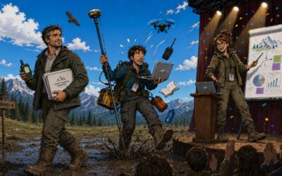
Equipped with various technology, the team is collecting multi-spectral and thermal Unoccupied Aerial System (UAS) data to analyze the vegetation. By collaborating closely with botanists, they aim to gain deeper insights into how environmental changes influence savanna ecosystems over time.
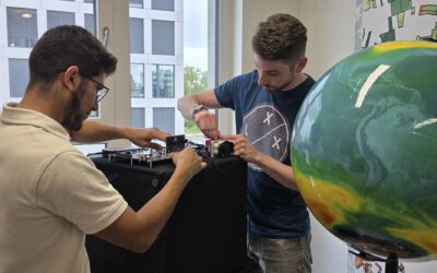
Their work requires a range of specialized equipment, including an Emlid for precise positioning and Ground Control Points (GCPs) to ensure accurate cross-calibration of their data. These tools allow them to capture high-resolution imagery and detect subtle changes in vegetation that might be invisible to space-borne sensors.
Fire and drought are two of the most significant natural disturbances affecting African savannas. Understanding how vegetation responds to these stressors is crucial for conservation efforts, sustainable land management, and predicting future ecological shifts under climate change. By leveraging remote sensing techniques, their research is helping to bridge the gap between field observation and large-scale environmental monitoring.
Their work is not only a testament to scientific curiosity but also of collaboration. Working alongside local and international experts, they are integrating diverse knowledge systems to create a more comprehensive understanding of savanna dynamics.
As their field campaign unfolds, we look forward to the insights they will bring back. Stay tuned for updates on their journey and discoveries from the heart of Africa’s savannas!
Equipped with various technology, the team is collecting multi-spectral and thermal Unoccupied Aerial System (UAS) data to analyze the vegetation. By collaborating closely with botanists, they aim to gain deeper insights into how environmental changes influence savanna ecosystems over time.
Their work requires a range of specialized equipment, including an Emlid for precise positioning and Ground Control Points (GCPs) to ensure accurate cross-calibration of their data. These tools allow them to capture high-resolution imagery and detect subtle changes in vegetation that might be invisible to space-borne sensors.
Fire and drought are two of the most significant natural disturbances affecting African savannas. Understanding how vegetation responds to these stressors is crucial for conservation efforts, sustainable land management, and predicting future ecological shifts under climate change. By leveraging remote sensing techniques, their research is helping to bridge the gap between field observation and large-scale environmental monitoring.
Their work is not only a testament to scientific curiosity but also of collaboration. Working alongside local and international experts, they are integrating diverse knowledge systems to create a more comprehensive understanding of savanna dynamics.
As their field campaign unfolds, we look forward to the insights they will bring back. Stay tuned for updates on their journey and discoveries from the heart of Africa’s savannas!