new article: Free and open-access satellite data are key to biodiversity conservation

new article: Free and open-access satellite data are key to biodiversity conservation

December 30, 2014

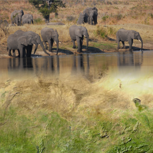
resized_earth-observation_org_WegmannBevanda_phil_trans_elefantsOur new article just got published in Biological Conservation. It is based on various workshop outcomes organized by NASA/WCS, CEOS Biodiversity and others in the past 2 years. The free and open access policy for space borne earth observation is crucial for global biodiversity research and conservation.


Satellite remote sensing is an important tool for monitoring the status of biodiversity and associated environmental parameters, including certain elements of habitats. However, satellite data are currently underused within the biodiversity research and conservation communities. Three factors have significant impact on the utility of remote sensing data for tracking and understanding biodiversity change. They are its continuity, affordability, and access. Data continuity relates to the maintenance of long-term satellite data products. Such products promote knowledge of how biodiversity has changed over time and why. Data affordability arises from the cost of the imagery. New data policies promoting free and open access to government satellite imagery are expanding the use of certain imagery but the number of free and open data sets remains too limited. Data access addresses the ability of conservation biologists and biodiversity researchers to discover, retrieve, manipulate, and extract value from satellite imagery as well as link it with other types of information. Tools are rapidly improving access. Still, more cross-community interactions are necessary to strengthen ties between the biodiversity and remote sensing communities.

W. Turner, C. Rondinini, N. Pettorelli, B. Mora, A.K. Leidner, Z. Szantoi, G. Buchanan, S. Dech, J. Dwyer, M. Herold, L.P. Koh, P. Leimgruber, H. Taubenboeck, M. Wegmann, M. Wikelski, C. Woodcock

Free and open-access satellite data are key to biodiversity conservation

Biological Conservation, Volume 182, February 2015, Pages 173-176

http://www.sciencedirect.com/science/article/pii/S000632071400473X

you may also like:

PhD position: Earth Observation of drought and fire impacts

PhD position: Earth Observation of drought and fire impacts

Job Announcement: PhD Position on EO research of Drought, Fire and Vegetation in Kruger National Park, South Africa Position: PhD ResearcherStudy Area: Kruger National Park, South AfricaApplication Deadline: until position is filledStart Date: as soon as possible...

Presentation at Wiener Planungswerkstatt

Presentation at Wiener Planungswerkstatt

On 16 January 2025, an evening event on the topic of urban development took place at the "Wiener Planungswerkstatt" in Vienna – see here: https://www.linkedin.com/events/wieundwowirwohnen-wollen-soziol7271805797850861569/about/. The event was organized and...

Visit to Seestadt Aspern in Vienna

Visit to Seestadt Aspern in Vienna

Vienna's Seestadt Aspern is one of the current largest urban development areas in Europe. By the 2030s, a brand new city will be fully completed in the east of Vienna. Living space for more than 25,000 people and over 20,000 jobs, education, and formation...

Exchange with colleagues from AIT Austrian Institute of Technology

Exchange with colleagues from AIT Austrian Institute of Technology

On 16 January 2025, Ariane Droin, Henri Debray and Hannes Taubenböck from EORC and the EOC of DLR were invited to the AIT Austrian Institute of Technology GmbH in Vienna as part of the UrbanSky project. The Urban Sky research project is carrying out a needs and...

Empowering Students with SAGA GIS for Environmental Applications

Empowering Students with SAGA GIS for Environmental Applications

At EAGLE Earth Observation, we are committed to equipping our students with the tools and knowledge needed to excel in the field of environmental science. As part of this effort, our students are exploring the power of various scientific open-source software packages...

EUSI meets GZS

EUSI meets GZS

Following the European Space Imaging Conference (EUSI) in December 2024 (DLR and EORC contributed to the conference. We reported on this – please see here: https://remote-sensing.org/keynote-presentation-at-eusi-conference-2024/), the long-standing partners met...