In a world where summers grow ever hotter, understanding and combating urban heat islands is becoming more urgent than ever. A recent study by our Prof. Hannes Taubenboeck sheds new light on this challenge—and at its helm is Dr. Tobias Leichtle, Dr. Thilo Erbertseder and Prof. Dr. Hannes Taubenböck, who is head of GZS at DLR and the head of the Chair of the Department of Global Urbanization and Remote Sensing, a joint position between DLR and Julius-Maximilians-Universität Würzburg.
Mapping Heat Across Germany’s Cities
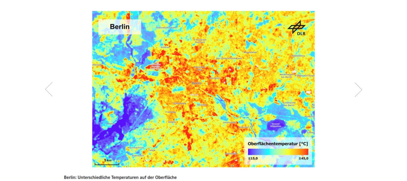
The researcher performed a comprehensive analysis of land surface temperature (LST) patterns during summer (June–August) from 2013 to 2024 across more than 70 German urban areas—cities with populations exceeding 100,000. Using thermal imagery from Landsat satellites, they uncovered how extensively sealed, densely built areas exhibit pronounced heat burdens—clear indicators of urban heat islands.
Although surface temperatures aren’t identical to air temperatures, they closely reflect the same spatial patterns. This alignment makes them a valuable proxy for identifying heat-prone zones within cities.DLR
These findings offer a powerful, data-supported foundation for decision-makers—municipalities, regional planners, and public agencies—empowering them to craft targeted interventions to mitigate heat stress in urban environments.DLR
The Role of Urban Research
Prof. Taubenböck leads research in urban phenomena such as the heat island effect, urban morphology, and the intersection of Earth observation with societal challenges. His expertise centers on transforming satellite data into actionable insights about urban environments.geographie..uni-wuerzburg.de This study exemplifies how such knowledge can be leveraged for societal good—offering precise temperature mapping and unveiling spatial heat distributions, thereby contributing to climate adaptation and urban resilience.
Why This Matters
-
Actionable Intelligence: Local authorities can now pinpoint hottest areas and prioritize green infrastructure, cooling pavements, or shaded public spaces precisely where they are most needed.
-
Science-Policy Bridge: Projects like this highlight how remote sensing, advanced processing, and urban science converge to support informed, evidence-based urban planning.
-
Holistic Relevance: The research aligns with Prof. Taubenböck’s broader interests—urban vulnerability, environmental exposure, and the smart use of satellite data to understand and address challenges in our rapidly urbanizing world.
Further Reading
For full details of the research and interactive visualizations, check out the DLR news release:
DLR zeigt hohe Hitzebelastung in deutschen Großstädten – a comprehensive summary of the surface temperature study and its implications for German cities.

