
New Funded Project on Automated Detection of Mining Areas

New Funded Project on Automated Detection of Mining Areas

December 17, 2025

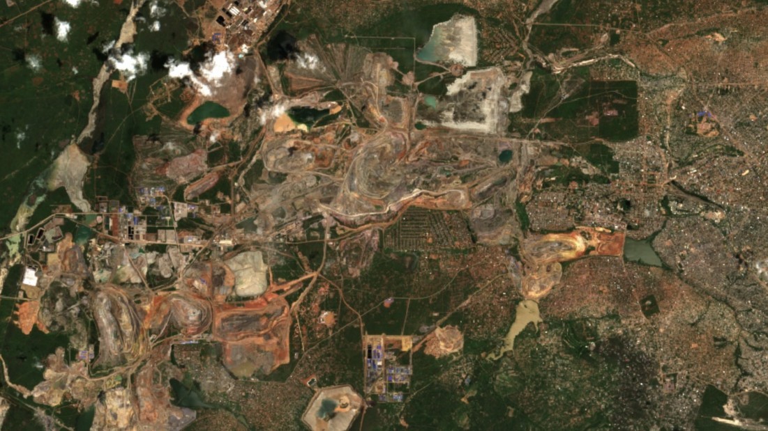
In a newly launched research project funded by the KSB Foundation, we focus on the automated identification of mining areas based on remote sensing data. The aim is to systematically detect large-scale mining activities and to track their spatial and temporal development.

Building on this, the project seeks to quantify the temporal dynamics of mining sites and the associated environmental changes using model-based approaches. This includes, for example, estimates of water consumption, amounts of extracted ore, and other indicators related to land surface change over time.

A particular focus is placed on cobalt, a metal that is essential for the energy transition and is predominantly mined in the southern part of the Democratic Republic of the Congo (DRC). Despite its growing global importance, the environmental and societal impacts of cobalt mining are still insufficiently quantified at larger spatial scales.

In addition to mining activities themselves, the project also addresses settlement dynamics in the vicinity of mining areas. The region around Kolwezi provides a striking example of the close relationship between the expansion of mining areas and surrounding settlement development. Characterizing and quantifying these interactions represents a key component of the project.

By combining remote sensing, spatial analysis, and modeling, the project aims to contribute to a better understanding of mining-related dynamics and to provide a data-driven basis for future environmental and sustainability assessments.

follow us and share it on:

you may also like:

GLS-team visits Planetary Health exhibition

GLS-team visits Planetary Health exhibition

One of the aims of Geolingual Studies Geolingual Studies - Geolingual Studies is to ensure effective science communication beyond the scientific community and into the wider society. The Geolingual Studies team was given the opportunity to look at concepts and methods...

Mapping Lava Tubes on Mauritius with iPhone Pro LiDAR

Mapping Lava Tubes on Mauritius with iPhone Pro LiDAR

Lava tube structures on Mauritius are quite hard to survey - tight, dark, and largely inaccessible to classical scanning equipment. As part of ongoing research by Dr. Kim Lea Holzmann (Chair of Animal Ecology and Tropical Biology, University of Würzburg), we're...

bzgl. Art. 50 Verordnung (EU) 2024/1689 (AI Act):

Überwiegend werden eigene originäre Texte und Bilder des EORC genutzt, jedoch sind einige Inhalte von blog post Texten teilweise mit Hilfe von KI überarbeitet worden und einige Bilder sind ganz mit KI erstellt, die jedoch deutlich keine photorealistische Darstellungen abbilden. Aussnahmen sind KI generierte fernerkundliche Datensätze, die explizit für Forschungszwecke mit KI erstellt wurden, hier wird aber durch den assoziierten Text der wissenschaftliche Grund der KI generierten Bilder erläutert.

Privacy Policy

Lehrstuhl für Fernerkundung & Lehrstuhl für Urbane Fernerkundung

Erdbeobachtung an der Universität Würzburg

Share This