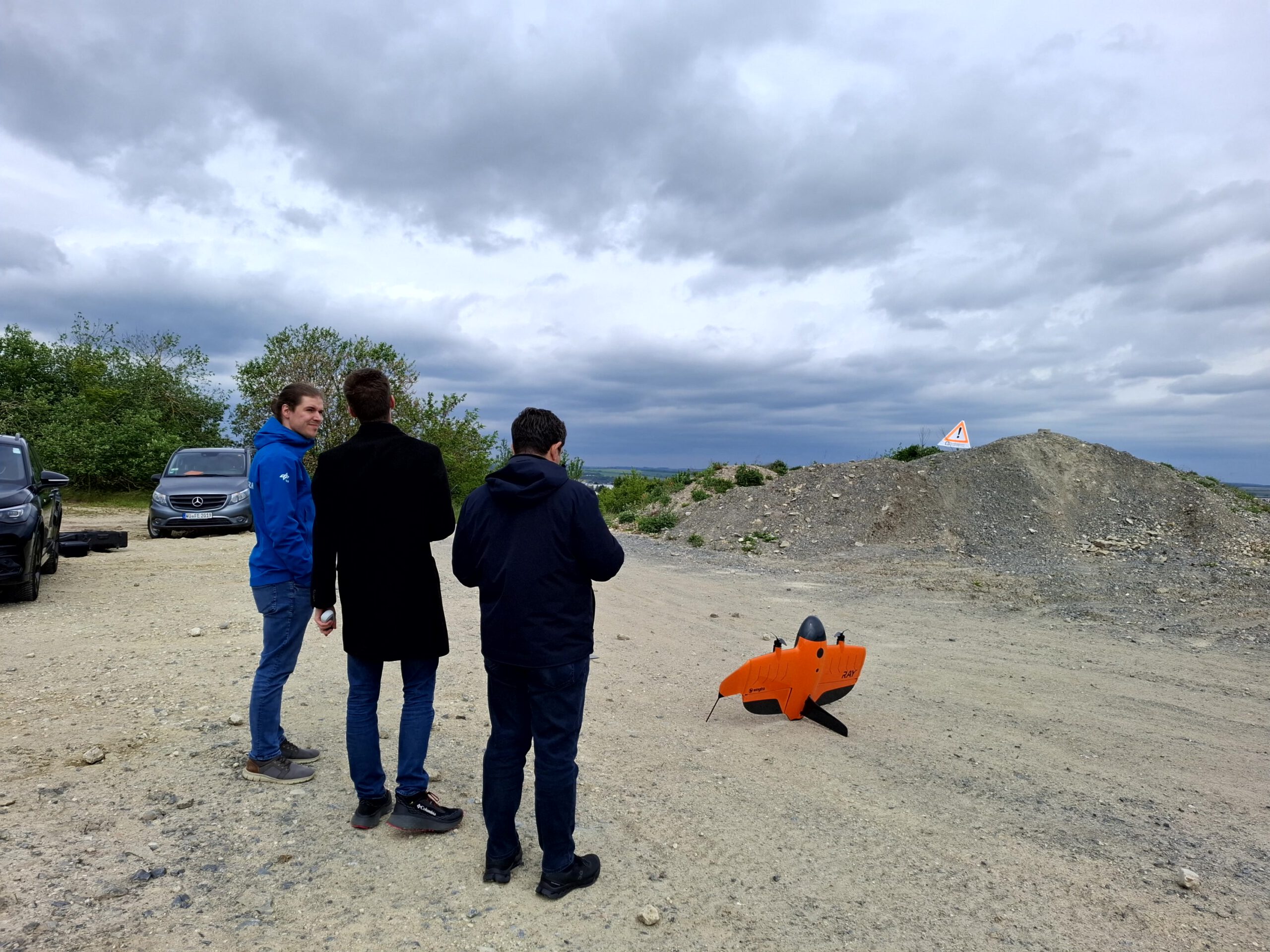
Is it possible to combine the efficiency of a fixed-wing drone with the precision of a laser scanner? That question brought researchers from EORC together with Wingtra, a Swiss company designing and manufacturing fixed-wing UAS, to exchange on UAS research and discuss current technological developments. UAS team members Antonio José Castañeda-Gómez, Dr. Mirjana Bevanda and Dr. Jakob Schwalb-Willmann presented our UAS research activities at EORC – from the African savannas through European temperate forests and agricultural fields to the Arctic tundra. Our guests from Wingtra, Mohamed Thoraia and Alessandro Solano, introduced our UAS team to Wingtra’s newest UAS, a fixed-wing vertical take-off and landing (VTOL) drone, capable of carrying a LiDAR sensor.
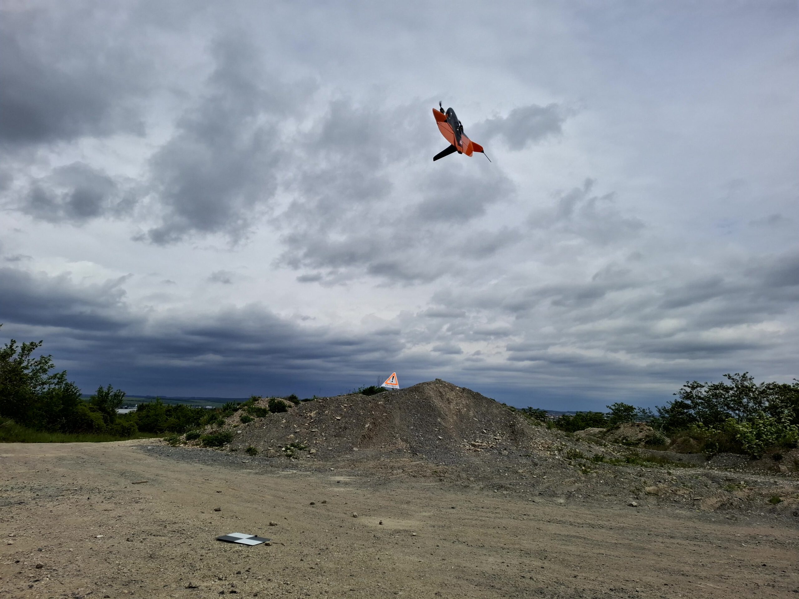
Fixed-wing drones are drones that fly like airplanes on wings. Unlike copters, they produce uplift using their wing when moving forward, a principle much more energy-efficient than staying airborne purely using propellers. While being more energy-efficient, a fixed-wing drone must move forward at a speed large enough to maintain uplift. This limitation has made it challenging to operate an imaging LiDAR sensor on a fixed-wing drone in the past. A LiDAR sensor emits laser beams and records their arrival back at the sensor after being reflected off the surface below, measuring the time elapsed between emission and detection at the sensor. Since laser beams travel at the speed of light, one can map the distance of the point of reflection from the sensor, allowing to derive point clouds representing the land surface in 3D. The more laser beams are shot at the surface, the higher the point density of the generated 3D point cloud becomes.
However, the faster the drone moves, the fewer points the laser can measure on the surface, resulting in a sparser 3D point cloud. Besides this efficiency trade-off, achieving high accuracy in the geo-allocation of points in 3D space poses its own challenge. The system must know its orientation across all of its axes at all times with high accuracy to calculate in which direction the laser beam had been shot. Copters can compensate axis movements using gimbals, a type of mount that keeps the sensor always leveled, e.g. at nadir view. A fixed-wing drone, however, usually cannot accommodate a gimbal, as that would negatively affect aerodynamics. Thus, the sensor is experiencing the movements of the drone, around all flight axes. This requires precise measurement of sensor orientation throughout the flight to later reconstruct the angle at which points were measured.
Due to all of this, it has been an engineering challenge to build a fixed-wing drone system that can maintain sufficient point densities at high accuracies even though it is flying fast and without a gimbal. Only a few manufacturers have managed to solve the aforementioned challenges, one of which is Wingtra.
We have thus been curious to learn about the performance of their solution. As part of the exchange with Wingtra, our guests performed a demonstration flight to show the UAS in action and to record data at a site close to our University campus. This allowed us to later-on inspect data accuracy by comparing the recorded data against data previously recorded using other platforms and sensors.
The meeting offered a great opportunity for us to exchange with Wingtra on our diverse uses of UAS technology in University remote sensing research and education, and our current and future user needs in the areas of mission planning, flight, and sensor data processing, while learning about the most recent technological advancements in civil UAS design and development.