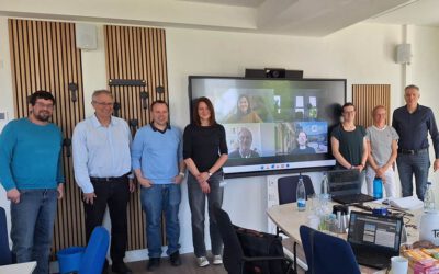
On 12 May, we had the pleasure of holding a meeting at the Earth Observation Center (EOC) of the German Aerospace Center (DLR) in Oberpaffenhofen as part of our DFG project “Räumliche Struktur und Governance der urbanen Verdichtung – zwischen raumplanerischem Gestaltungsanspruch und Marktsteuerung” [engl.] Spatial structure and governance of urban densification – between spatial planning and market control”, which started this year. With our project partners from TU Dortmund University, Prof. Dr. Stefan Siedentop and Maximilian Schartmann, we discussed how we can record and analyze built-up densification in German cities with high spatial resolution multi-sensoral remote sensing data over a period of about 10 years and use this empirical basis to better understand densification in its planning framing and control. Based on this long-standing cooperation between DLR and TU Dortmund University, the aim here is to better understand urbanization in Germany through interdisciplinary research.
For earlier joint works of this team, we refer to:
- Dynamics of intra-urban employment geographies: A comparative study of U.S. and German metropolitan areas https://www.tandfonline.com/doi/full/10.1080/07352166.2022.2122833
- In the tension between large-scale analysis and accuracy – Identifying and analysing intra-urban (sub-)centre structures comparing official 3D-building models and TanDEM-X nDSMs https://www.sciencedirect.com/science/article/pii/S0198971523000169
- Quantitative assessment and comparison of urban patterns in Germany and the United States https://www.sciencedirect.com/science/article/pii/S0198971522001648
- Patterns of Eastern European Urbanisation in the Mirror of Western Trends – Convergent, Unique or Hybrid? https://journals.sagepub.com/doi/full/10.1177/2399808319846902
- Large-Area Characterization of Urban Morphology – Mapping Built-Up Height and Density with the TanDEM-X Mission and Sentinel-2 https://ieeexplore.ieee.org/document/8745682
- Urbanization between compactness and dispersion – Designing a spatial model for measuring 2D binary settlement landscape configurations https://www.tandfonline.com/doi/full/10.1080/17538947.2018.1474957
- Measuring morphologic polycentricity – A comparative analysis of urban mass concentrations using remote sensing data https://www.sciencedirect.com/science/article/pii/S0198971517300479
- A comprehensive view on urban spatial structure: Urban density patterns of German city regions https://elib.dlr.de/104421/1/ijgi-05-00076.pdf
- Dichter dran! Neue Möglichkeiten der Vernetzung von Geobasis-, Statistik- und Erdbeobachtungsdaten zur räumlichen Analyse und Visualisierung von Stadtstrukturen mit Dichteoberflächen und –profilen https://publications.rwth-aachen.de/record/780933