New RapidEye datasets granted from RESA platform of DLR/Black Bridge

New RapidEye datasets granted from RESA platform of DLR/Black Bridge

October 21, 2015

The Dept. of Remote Sensing recently applied for a time series of 12 RapidEye scenes to support a PhD thesis by Siddhartha Khare (Indian Institute of Technology Roorkee, India). The proposal is now accepted, and th PhD work will be supported by a dense time series of RapidEye scenes acquired in 2013 over dry forests in Lesser Himalayan region of India.

The PhD thesis which will use these processed datasets is entitled  “Object Based approaches for remote sensing-assisted assessment of forest biodiversity focusing on invasive species”, supervised and advised by Prof. S.K. Ghosh (IIT Roorkee) and Dr. Hooman Latifi (University of Würzburg). Additional multisource datasets to be used within the work include time series of Landsat 8 data and Cartosat 2-derived terrain model.

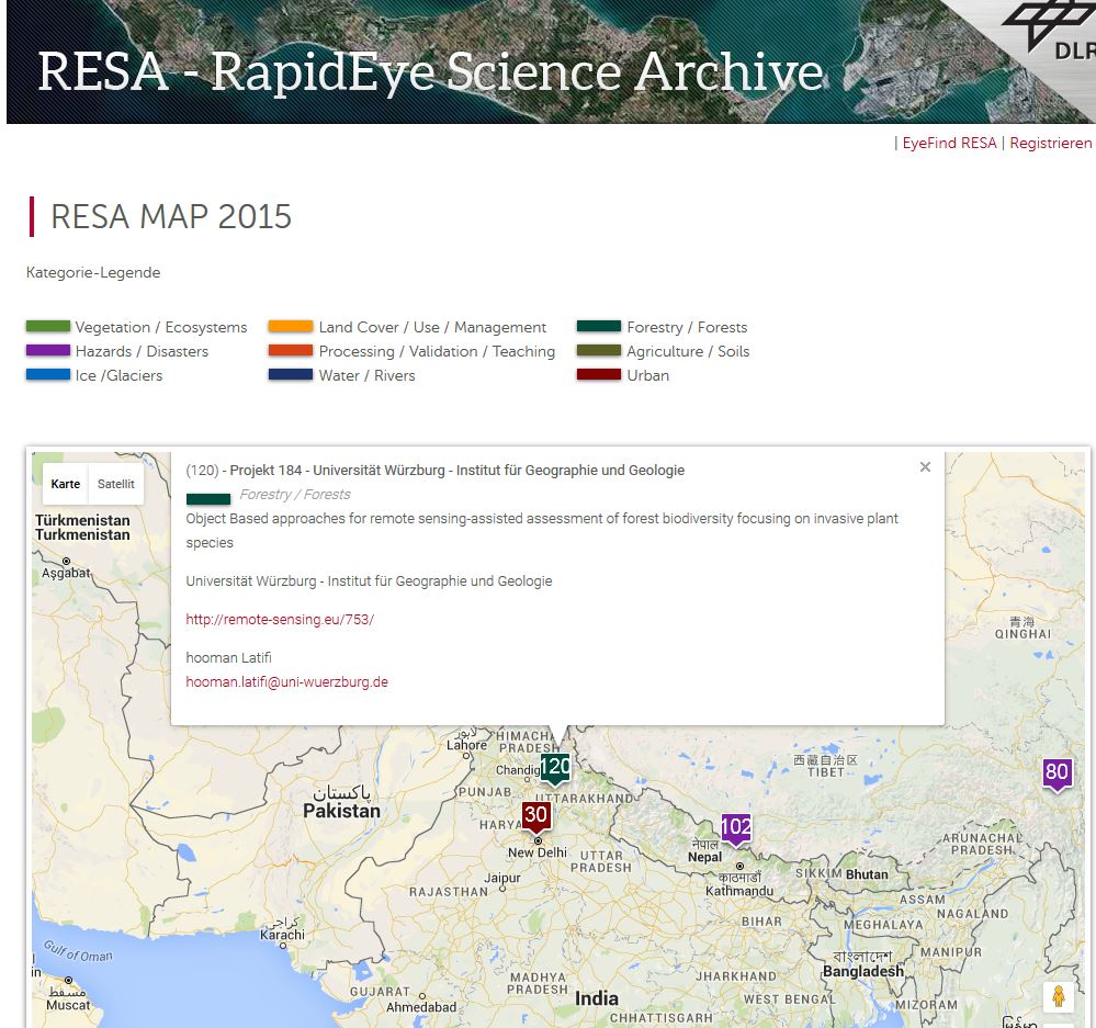
RESA already published this project in RESA project map 2015 which can be found online HERE. The project area is flagged under No. 120 (project number 184) in the map.

resa_india

follow us and share it on:

you may also like:

Remote sensing insights into biogas flowering mixtures

Remote sensing insights into biogas flowering mixtures

Perennial wildflower mixtures are gaining importance as an alternative to maize in biogas production. As highlighted in the praxis-agrar article on crop diversification with biogas flowering mixtures, they combine agricultural use with clear ecological benefits....

PhD submitted by Julia Rieder

PhD submitted by Julia Rieder

We are pleased to share that our PhD student Julia Rieder has successfully submitted her doctoral thesis! Her dissertation, entitled “Abiotic and biotic drivers of drought responses in European beech (Fagus sylvatica L.) inferred from field and LiDAR data”,...

New Funded Project on Automated Detection of Mining Areas

New Funded Project on Automated Detection of Mining Areas

In a newly launched research project funded by the KSB Foundation, we focus on the automated identification of mining areas based on remote sensing data. The aim is to systematically detect large-scale mining activities and to track their spatial and temporal...

Share This