AgriSens DEMMIN 4.0 at Agritechnica

AgriSens DEMMIN 4.0 at Agritechnica

November 14, 2023

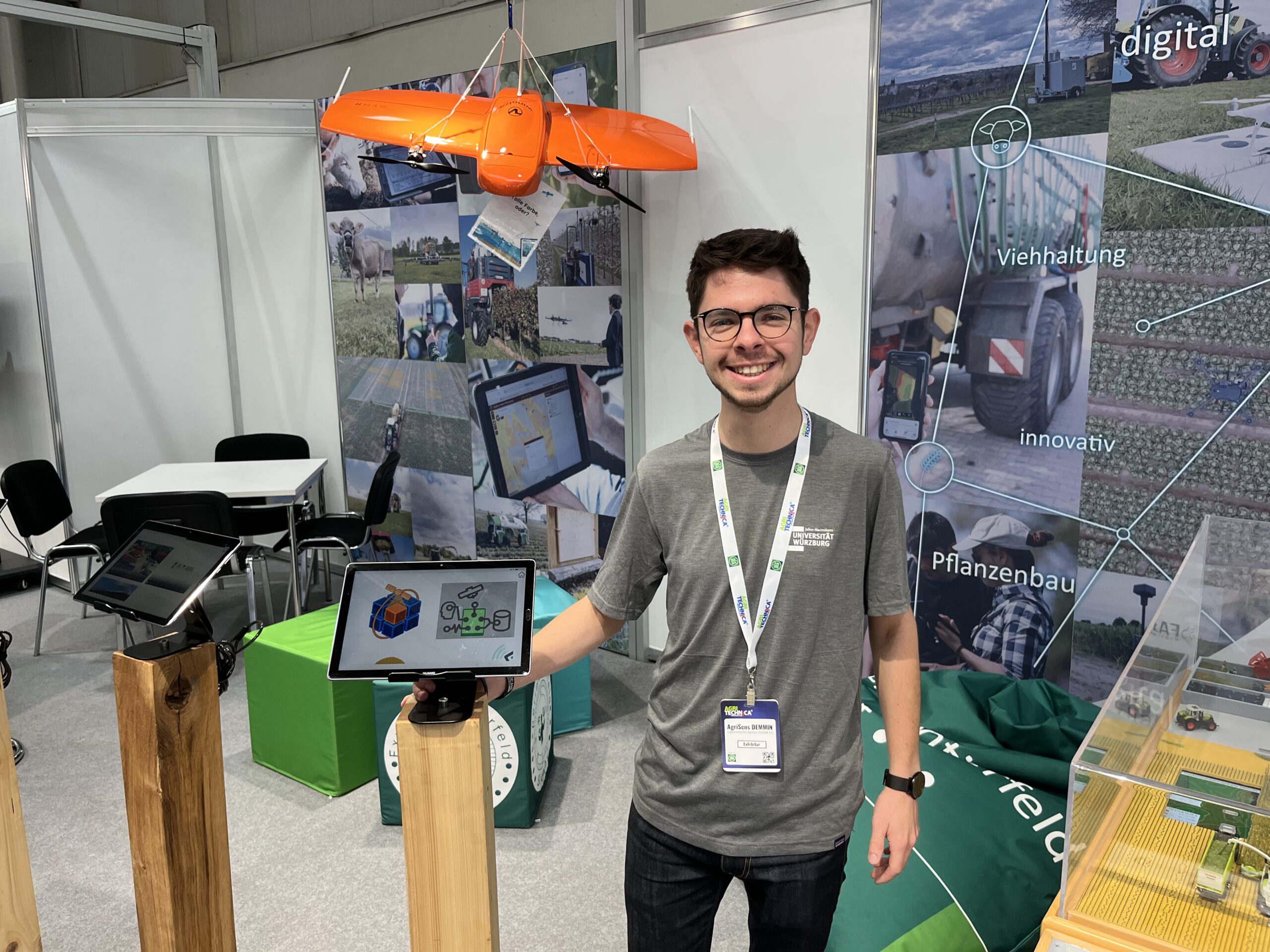
These days, our colleague Christoph Friedrich is in Hannover to represent the AgriSens DEMMIN 4.0 project at AGRITECHNICA. This event is the world’s biggest agricultural trade fair, and although the focus of course is on huge machinery such as tractors or harvesters, there is also a lot of digital transformation happening in the industry. For example, data services are becoming increasingly important for decision making on today’s farms. This is where our research project comes into play: AgriSens DEMMIN 4.0 is advancing the usage of remotely sensed data in crop farming. It is part of the “experimental fields” initiative funded by the German Ministry of Agriculture, which consists of a total of 14 projects who operate a joint booth at the fair.

Among the exhibits is a Wingtra fixed-wing drone, which our project partners use to collect high resolution aerial imagery of the fields. The data can be used to assess the status of the plants in the field, so that for example areas of lower vitality can be identified and the appropriate measures taken. This can be combined with data from satellites — a process that needs a big data archive and a lot of processing power. In our Earth Observation Research Cluster, we develop so-called datacubes to simplify data handling and processing. Our IT infrastructure combines data from various sources, facilitates its processing, and delivers the results to the end user, so that agriculturalists can profit from the valuable information that is captured from above.

you may also like:

Project meeting NetCDA

Project meeting NetCDA

The first annual NetCDA project meeting took place in Würzburg on November 21st, 2024. Together with all German and West African partners from the West African Science Service Centre on Climate Change and Land Use (WASCAL), we have laid the foundation for our future...

The EORC can also be found on bluesky

The EORC can also be found on bluesky

We are active on various social media channels but in the last weeks we monitored a very strong increase of scientists joining bluesky and following our activities on that platform. Therefore we decided to be more active on bluesky and post regular news about our...

Blender GIS introduction

Blender GIS introduction

Within out EAGLE Earth Observation M.Sc. we also cover software applications which might not be used on a regular basis within our field of research but are sometimes highly useful to display our spatial data in a visually appealing way - and also potentially provides...

EAGLE presentation by Gökçe Yağmur Budak

EAGLE presentation by Gökçe Yağmur Budak

On November 26, 2024, Gökçe Yağmur Budak will present her internship results on " Leveraging Data-Driven Approaches for Seismic Risk Assessment in Istanbul " at 12:30 in seminar room 3, John-Skilton-Str. 4a. From the abstract: This internship aims to create time...

JURSE – deadline for paper submission extended

JURSE – deadline for paper submission extended

JURSE - Joint Urban Remote Sensing Event   The 17th International Conference on Joint Urban Remote Sensing (JURSE), organized by Higher School of Communication of Tunis (SUP'COM) will take place in Tunisia from 4 to 7 May 2025. https://2025.ieee-jurse.org/ ;...