‘Ecosystem Services of the Urban Forest’-project meeting at DLR

‘Ecosystem Services of the Urban Forest’-project meeting at DLR

March 7, 2025

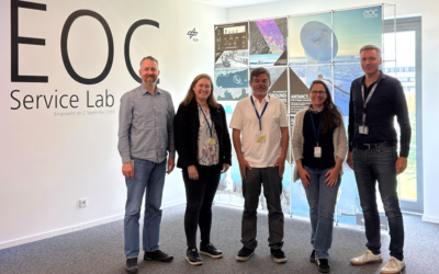
As part of the project “Ecosystem Services of the Urban Forest: area-wide modeling based on remote sensing and artificial intelligence” funded by the Deutsche Bundesstiftung Umwelt (DBU), the core team met at the Earth Observation Center (EOC) of the German Aerospace Center (DLR) in Oberpfaffenhofen to present and discuss the findings from the last three years. In the meeting participated Andrea Sofia Garcia from our EORC, Tobias Leichtle from DLR, Thomas Rötzer and Stephan Pauleit from the Technical University of Munich, Klaus Martin from the Company for Remote Sensing and Environmental Research and Hannes Taubenböck from DLR and the EORC.

This project focused on large-scale modeling of urban tree ecosystem services using high-resolution aerial and satellite imagery combined with AI-based analysis. Urban trees provide crucial benefits such as cooling, run-off capture, and carbon storage, which help mitigate the impacts of climate change in cities. However, quantifying these services on a larger scale has been a challenge due to a lack of detailed data.

To bridge this gap, our remote sensing-based data was integrated into the CityTree model, enabling area-wide ecosystem service estimations for common Central European tree species in urban areas. We are excited about the potential impact of this work in facilitating the implementation of climate adaptation strategies by end users such as municipalities and urban planner.

We look forward to further collaborations that contribute to more sustainable and resilient cities


you may also like:

Visit at the Institute for Geoinformatics (IFGI) at University of Münster

Visit at the Institute for Geoinformatics (IFGI) at University of Münster

Two days ago, our PostDoc Dr. Jakob Schwalb-Willmann visited the Institute for Geoinformatics at University of Münster to give a talk at IFGI’s GI Forum titled “Can animals be used to classify land use? Employing movement-tracked animals as environmental informants using deep learning”.

EOCap4Africa training in Ruhengeri

EOCap4Africa training in Ruhengeri

This week, over 25 students are attending a training session at the Institute of Applied Sciences (INES) in Ruhengeri, Rwanda, using the MSc module on Remote Sensing for Biodiversity Conservation that we developed. This module is part of the EOCap4Africa project...

New Team Member at the EORC: Sonja Mass

New Team Member at the EORC: Sonja Mass

Sonja Maas joined the Earth Observation Research Cluster (EORC) in October 2025 as a research assistant for the EO4CAM project. After finishing her bachelor's degree in forestry, Sonja Maas enrolled in the EAGLE M.Sc. program at the University of Würzburg, where she...

Field Excursion to Owabi Wildlife Sanctuary

Field Excursion to Owabi Wildlife Sanctuary

As a highlight of the third day of our training at KNUST on the use of remote sensing for biodiversity conservation, we took our participants on a field excursion to the nearby Owabi Wildlife Sanctuary. Guided by experienced local experts, we explored the area and had...

Expedition to Central Asia in the frame of the FluBig project

Expedition to Central Asia in the frame of the FluBig project

Since mid of September, a team from the Earth Observation Research Cluster is on a field expedition at the Naryn River in Kyrgyzstan. The team is acquiring data on vegetation and hydro-geomorphic features for the DFG funded "FluBig" project which is dedicated to...