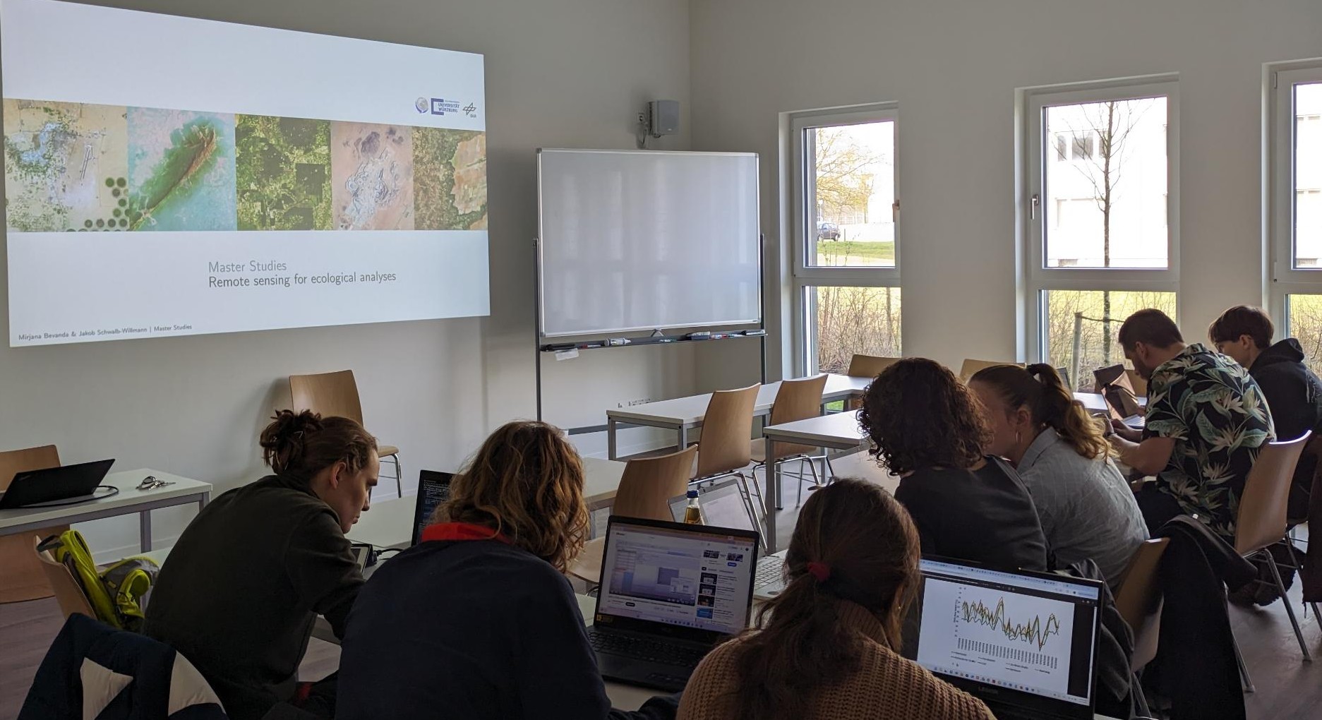
At the intersection of technology and ecology, geo-spatial data and remote sensing are revolutionizing the way we understand and manage our environment. As part of the EcoGlob collaboration, Jakob Schwalb-Willmann and Luisa Pflumm once again led an exciting two-week course aimed at equipping biology students with essential skills in handling and analyzing geo-spatial and remote sensing data for ecological research.
Whether it’s tracking deforestation, assessing wildlife habitats, or studying environmental change, the ability to effectively process and interpret remote sensing data is a powerful tool for ecologists. This course, which took place within the framework of the collaboration between our Earth Observation and the biology department, gave students the hands-on experience and theoretical foundation necessary to integrate remote sensing into their future research projects.
Week 1: Laying the Groundwork for Spatial Data Analysis
In the first week, Jakob and Luisa guided students through an essential introduction to the world of geo-spatial data and remote sensing, with a focus on making sense of data from multiple sources. Students were introduced to QGIS and R, two of the most powerful tools for spatial data analysis.
Key Topics Covered:
-
Applications and Physical Principles: Students learned about the various applications of remote sensing in ecology, including land cover classification and environmental monitoring. They were also introduced to the physical principles behind remote sensing, such as spectral bands and how different wavelengths can reveal unique information about Earth’s surface.
-
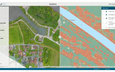
Data Types: Remote sensing data comes in two primary types—raster and vector. Understanding the differences, uses, and advantages of these data types is crucial for working with spatial data, and students explored both formats in depth.
-
Coordinate Reference Systems (CRS) and Projections: Students were introduced to the world of georeferencing, learning how to align data from different sources to a common spatial framework. The correct use of CRS and projections is fundamental for ensuring that different datasets can be effectively integrated.
-
QGIS and R: A hands-on introduction to QGIS and R helped students learn the basics of spatial data visualization and analysis. These tools are industry standards in the field, and mastering them gives students the technical expertise to handle complex ecological data.
-
Easing Interpretability with Spectral Indices: To enhance the interpretability of remote sensing data, students were introduced to spectral indices like NDVI (Normalized Difference Vegetation Index), which can be used to assess vegetation health and land cover changes.
-
Digitizing Ground Truth Data: Remote sensing is most powerful when paired with ground truth data. Students were taught how to manually digitize data from field observations, a key step in creating accurate models.
-
Supervised Classification and Regression Modelling: Students learned how to establish relationships between remote sensing data and ground truth observations. They applied supervised classification and regression models to predict ecological characteristics based on satellite imagery.
-
Zonal Statistics: Once students had classified their data, they were introduced to zonal statistics, which allows for the extraction of summary information from defined geographic regions, enabling more focused analysis.
-
Model Validation and Accuracy Assessment: To ensure that their models accurately represent reality, students learned how to validate and assess model accuracy through a variety of techniques, such as cross-validation and confusion matrices.
Week 2: Diving Deeper into Ecological Research with Remote Sensing
The second week of the course saw students move from theory into practical, real-world applications. The focus was on enabling students to independently use remote sensing and ground truth data to answer their own ecological research questions.
Aim of Week 2: Enabling Independent Ecological Analysis
Students were tasked with applying remote sensing techniques to real ecological problems. The ultimate goal was for students to develop the skills to design, implement, and validate their own research projects.
Key Topics Covered:
-
Assessing Data Requirements: Before diving into data analysis, students learned how to assess the data requirements of their specific research questions. This step is crucial for ensuring that the data being used will effectively address the aims of the study.
-
Acquiring and Pre-Processing Data: Students were trained in the process of acquiring remote sensing satellite data, as well as the steps involved in pre-processing both remote sensing and ground truth data. This included tasks such as atmospheric correction and data alignment, which are necessary to ensure the data is suitable for analysis.
-
Building, Training, and Validating Predictive Models: With ground truth data and remote sensing imagery in hand, students learned how to build predictive models. These models were then trained on the data and validated to ensure they could reliably upscale ground truth observations using remote sensing data.
-
Extracting Information from Data: Once the models were created, students learned how to extract valuable information, such as patterns, trends, and statistics, from their analyses. This process allows for the generation of actionable insights from large, complex datasets.
-
Evaluation and Reflection: The final step in the course was an evaluation of the methods and models used. Students reflected on the strengths and limitations of their approaches and discussed ways to improve or refine their models in future studies.
Real-World Impact of Remote Sensing in Ecology
By the end of the course, students had acquired a robust toolkit for conducting ecological research using geo-spatial and remote sensing data. This hands-on experience not only enhanced their technical skills but also opened up new possibilities for addressing ecological challenges.
As global environmental concerns such as climate change, habitat loss, and biodiversity decline continue to grow, remote sensing offers a powerful way to monitor and manage the planet’s ecosystems. With the skills gained in this course, students are now equipped to contribute to this rapidly evolving field and apply these techniques in their own research to make a positive environmental impact.
A Bright Future for EcoGlob and Ecological Research
This course is just one of many exciting initiatives being spearheaded through our Earth Observation interest to collaborate with other disciplines to make remote sensing accessible across disciplines. As Jakob and Luisa continue to inspire the next generation of ecologists, we can expect to see a growing community of researchers equipped to tackle the world’s most pressing environmental challenges—armed with the knowledge and tools of remote sensing and geo-spatial analysis.