Exhibition at the Week of the Environment

Exhibition at the Week of the Environment

June 7, 2024

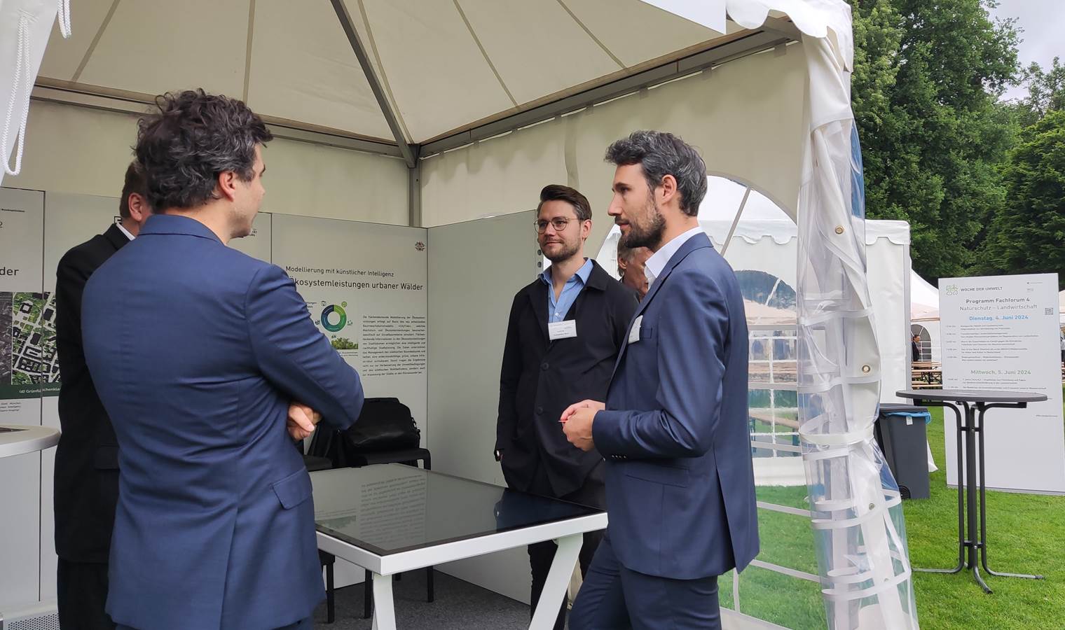
On 04.-05.06.2024 part of our team participated in the “Woche der Umwelt” (“Week of the Environment”), organized by the Federal President Frank-Walter Steinmeier and the German Federal Environmental Foundation (Deutsche Bundesstiftung Umwelt, DBU) in Berlin. As one of approximately 190 exhibitors, we presented our project “Ecosystem Services of the Urban Forest: Modeling Using Remote Sensing & Artificial Intelligence” funded by DBU.

Our project aims to comprehensively assess and quantify the ecosystem services provided by urban forests, such as reducing surface runoff, mitigating heat stress, and sequestering carbon. By leveraging remote sensing and artificial intelligence, we systematically characterize trees in Munich and Würzburg to estimate their ecosystem services. Our goal is to support intelligent and sustainable urban planning, fostering resilient green urban infrastructure, and aiding cities in climate change adaptation. This project is a collaboration of the Earth Observation Research Cluster from the Julius-Maximilians-University of Würzburg, the Chair of Forest Growth and Yield Science from TU Munich, the Company for Remote Sensing and Environmental Research (SLU), and the Department of Georisks & Civil Security from DLR, with additional support from UrbanSens. More details about the project can be found here: https://www.woche-der-umwelt.de/wdu-aussteller/julius-maximilians-universitaet-of-wuerzburg/

The “Woche der Umwelt” is an event hosted at the park of Schloss Bellevue in Berlin. It serves as an innovation showcase for environmental protection, featuring numerous exhibitions and specialized forums discussing topics ranging from sustainability in various industries to biodiversity conservation and climate resilience. Attendees have the opportunity to engage with experts and explore innovative solutions for environmental challenges. This event was a fantastic opportunity to communicate the importance of our project, demonstrate the potential of remote sensing, and engage in meaningful discussions that could lead to future collaborations.


you may also like:

Our research site and project covered by BR

Our research site and project covered by BR

The University forest at Sailershausen is a unique forest owned by the University of Wuerzburg. It comes with a high diversity of trees and most important is part of various research projects. We conducted various UAS/UAV/drone flights with Lidar, multispectral and...

Meeting of the FluBig Project Team

Meeting of the FluBig Project Team

During the last two days, the team of the FluBig project (remote-sensing.org/new-dfg-project-on-fluvial-research/) met at the EORC for discussing the ongoing work on fluvial biogeomorphology. After returning from a successful field expedition to Kyrgyzstan a couple of...

‘Super Test Site Würzburg’ project meeting

‘Super Test Site Würzburg’ project meeting

After the successful "Super Test Site Würzburg" measurement campaign in June (please see here: https://remote-sensing.org/super-test-site-wurzburg-from-the-idea-to-realization/ ), the core team from the University of Würzburg, the Karlsruhe Institute of Technology,...

EORC Talk: Geolingual Studies: A New Research Direction

EORC Talk: Geolingual Studies: A New Research Direction

On July 19th, Lisa Lehnen and Richard Lemoine Rodríguez, two postdoctoral researchers of the Geolingual Studies project, gave an inspiring presentation at the EORC talk series.   In the talk titled "Geolingual Studies – a new research direction", they...

EO support for UrbanPArt field work

EO support for UrbanPArt field work

From May to September, Karla Wenner, a PhD student at the Juniorprofessorship for Applied Biodiversity Science, will be sampling urban green spaces and semi-natural grasslands in Würzburg as part of the UrbanPArt project. Our cargo bikes support the research project...

Cinematic drone shots

Cinematic drone shots

We spend quite some time in the field conducting field work, from lidar measurements to vegetation samples in order to correlate it with remote sensing data to answer various research questions concerning global change. Field work is always a 24/7 work load and...