Field campaign in Côte d’Ivoire by a Ph.D. student of the Department of Remote Sensing

Field campaign in Côte d’Ivoire by a Ph.D. student of the Department of Remote Sensing

March 9, 2022

In November 2021, Dan Kanmegne Tamga, a Ph.D. student within the WASCAL-DE-Coop project at the Department of Remote Sensing at the University of Würzburg, went for a field campaign to Côte d’Ivoire, West Africa. Dan Kanmegne Tamga is working on estimating carbon sequestration in agroforestry systems.

The objective of his field campaign was to collect biometric parameters of trees. Using allometric equations, the parameters collected by him in situ (e.g., diameter and height) are used to derive the aboveground biomass (AGB).

Côte d’Ivoire is the world’s largest producer of cocoa beans, where cocoa plantations are established at the expense of forest. Because of the contribution of deforestation and forest degradation to climate change, AGB needs to be monitored in Côte d’Ivoire.

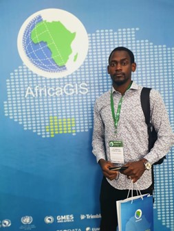
In the same period, Dan Kanmegne Tamga attended the AfricaGIS (EIS-AFRICA) conference held in Abidjan between 22 – 26 November. He presented the results of his study on modeling the spatial distribution of the classification error in agroforestry systems in Côte d’Ivoire. This research was funded by the German Federal Ministry of Education and Research (BMBF) with the technical support of the World Agroforestry Centre (ICRAF, Côte d’Ivoire).

Ph.D. student Dan Kanmegne Tamga at the AfricaGIS in November 2021.

follow us and share it on:

you may also like:

How We Learned to Fly: The Story Behind UAS Research at EORC

How We Learned to Fly: The Story Behind UAS Research at EORC

Every research group that's ever bought a drone has a story about the first one it lost. We're no different. So let's just get that out of the way up front: this is the inside story of how UAS (Unoccupied Aerial System) research grew up at the Earth Observation...

MainPro workshop on TLS and LiDAR UAS

MainPro workshop on TLS and LiDAR UAS

This week, a workshop organized by Sebastian Buchelt within our EFRE project MainPro brought together students, researchers, and interested project partners to explore modern UAV technologies. The workshop took place in vineyards close to Würzburg and gave the...

25 Years of Remote Sensing in Würzburg

25 Years of Remote Sensing in Würzburg

Our chair of remote sensing, Professor Stefan Dech, likes to say "science is rarely a sprint, it's a marathon". And if you look at what's grown out of Würzburg over the last 25 years, you'll see exactly what he means. In 2026 the Julius-Maximilians-Universität...

Starkregen in Bayern: Beobachtungen und Dokumentation zählen

Starkregen in Bayern: Beobachtungen und Dokumentation zählen

Starkregenereignisse treten immer häufiger lokal, kurzfristig und mit hoher Intensität auf. Innerhalb weniger Stunden können sie erhebliche Überschwemmungen und Schäden verursachen. Um solche Ereignisse künftig besser zu verstehen und die wissenschaftliche Grundlage...

Seeing the World in Points: Lidar Course for the EAGLEs

Seeing the World in Points: Lidar Course for the EAGLEs

Lidar has a funny way of sneaking up on you. You think you know what it is, a laser that measures distance, fine, but then someone shows you a point cloud of a forest canopy with individual branches floating in 3D space and suddenly you realize there's a whole...

TV Crew Films EORC at MONID Habitrack Fieldwork

TV Crew Films EORC at MONID Habitrack Fieldwork

A bit of extra excitement at EORC recently: A television crew showed up to film a segment on the MONID Habitrack project financed by the BMFTR, and Dr. Ariane Droin was right in the middle of it, walking them through what Earth...

Share This