New package published in the scope of the Central Asia Waters (CAWa). fieldRS was designed to support scientists and practitioners in the collection of ground-truth data by helping design field campaigns. It provides tools to identify priority sampling sites, map potential sampling plots and convert those plots into consistent training and validation samples. currently, fieldRS addresses field campaigns related to land cover classification. Future updated will also consider the collection of ground-truth data used in the prediction of continuous variables. A vignette with detailed examples can be found here.
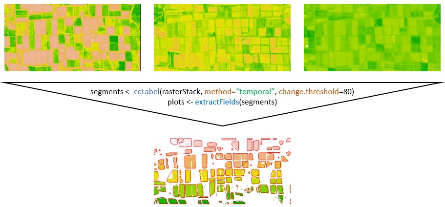
Translation of multi-temporal Normalized Difference Vegetation Index (NDVI) images into single sample plots using fieldRS.

