Flowmapper, a simple tool for visualizing geographic flows in R

Flowmapper, a simple tool for visualizing geographic flows in R

April 12, 2024

One of our PhD students, Johannes Mast, just released a new R package called “flowmapper” which he developed and used within his PhD.

Flowmapper (https://github.com/JohMast/flowmapper) is a new R package that allows users to create beautiful, informative maps of geographic movement. Inspired by the interactive flowmap.gl (https://flowmap.gl/), we designed flowmapper specifically to allow R users the creation of static and customizable scientific graphics. With flowmapper, users can easily visualize flows between geographic locations and customize the flowmaps by using the clear syntax and powerful tools of the ggplot ecosystem.

You can get started with flowmapper today and explore and visualize the patterns in geographic data! Download the package from GitHub and let us know what you think!

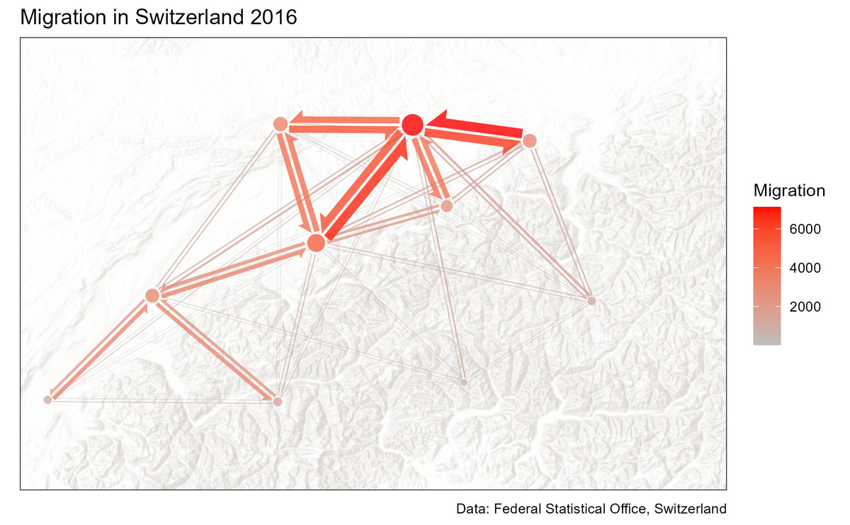
https://github.com/JohMast/flowmapper

you may also like:

PhD position: Earth Observation of drought and fire impacts

PhD position: Earth Observation of drought and fire impacts

Job Announcement: PhD Position on EO research of Drought, Fire and Vegetation in Kruger National Park, South Africa Position: PhD ResearcherStudy Area: Kruger National Park, South AfricaApplication Deadline: until position is filledStart Date: as soon as possible...

Exchange with colleagues from AIT Austrian Institute of Technology

Exchange with colleagues from AIT Austrian Institute of Technology

On 16 January 2025, Ariane Droin, Henri Debray and Hannes Taubenböck from EORC and the EOC of DLR were invited to the AIT Austrian Institute of Technology GmbH in Vienna as part of the UrbanSky project. The Urban Sky research project is carrying out a needs and...

Empowering Students with SAGA GIS for Environmental Applications

Empowering Students with SAGA GIS for Environmental Applications

At EAGLE Earth Observation, we are committed to equipping our students with the tools and knowledge needed to excel in the field of environmental science. As part of this effort, our students are exploring the power of various scientific open-source software packages...

EUSI meets GZS

EUSI meets GZS

Following the European Space Imaging Conference (EUSI) in December 2024 (DLR and EORC contributed to the conference. We reported on this – please see here: https://remote-sensing.org/keynote-presentation-at-eusi-conference-2024/), the long-standing partners met...

Successful Master Thesis Defense by Konstantin Müller

Successful Master Thesis Defense by Konstantin Müller

On January 14th, Konstantin Müller successfully defended his master’s thesis titled "Animal Path Segmentation and Analysis via Generalized Deep Neural Network Regression". Supervised by Jakob Schwalb-Willmann and Dr. Mirjana Bevanda, the presentation was delivered to...

Privacy Policy

Lehrstuhl für Fernerkundung & Lehrstuhl für Urbane Fernerkundung

Erdbeobachtung an der Universität Würzburg