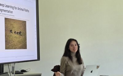
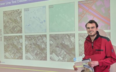
Our Master’s student Mahnoor Nadeem successfully presented her research project at the Innolab, showcasing an innovative approach to vegetation monitoring in a savannah ecosystem in Rwanda, namely Akagera National Park. Persistent cloud cover often limits the use of optical satellite data for calculating the Normalized Difference Vegetation Index (NDVI). To address this challenge, the project explored the use of Sentinel-1 SAR–derived indices for gap-filling NDVI time series. Vegetation-related features derived from VV and VH backscatter data were combined with elevation data to train a Random Forest regression model. A segment-based approach was applied to improve spatial consistency, while cloud-free Sentinel-2 data were used for training and validation. The model achieved an accuracy of approximately 60%, demonstrating the potential of SAR data for NDVI estimation in cloud-prone regions. While spatial smoothness was improved, limitations remained in capturing fine-scale details and extreme NDVI values. The presentation sparked valuable discussion and was very well received.
The InnoLab was supervised by Dr. Insa Otte and Sebastian Buchelt.
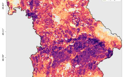
Successful MSc Defense: Developing a Farmland Habitat Biodiversity Indicator for Bavaria
On March 31, 2026, Suriya Elango successfully defended his Master’s thesis at the Earth Observation Research Cluster (EORC), University of Würzburg. His work addressed a question that is becoming increasingly important across Europe: how can biodiversity in...