
On December 17, 2024, Ariana Sofía Argüello Cordero will present her internship ” Application of synthetic aperture radar (SAR) data: Case study in flood mapping in Costa Rica and technical capacity building of the PRIAS team” at 12:00 in seminar room 3, John-Skilton-Str. 4a.
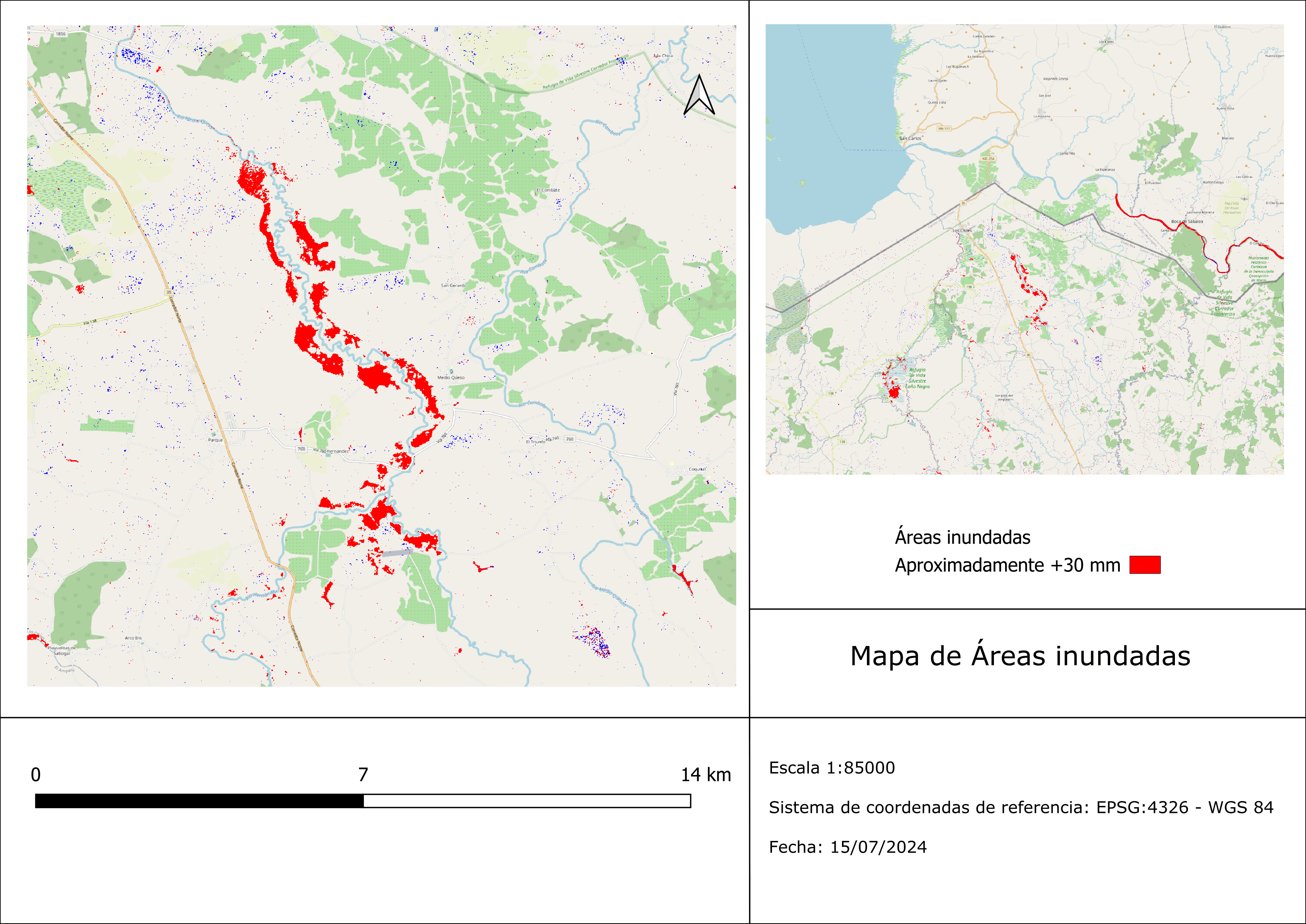
From the abstract: Floods are considered one of the most dangerous natural hazards. Their intensity and frequency has increased in recent years worldwide due to climate change and urbanization. Hence, the detection and mapping of floods using SAR synthetic aperture radar imagery in this case in Costa Rica allows effective monitoring and identification of flooded areas for future events in the country and their early risk assessment. In tropical areas, cloud cover is abundant and constant, and the application of optical sensors is limited, therefore, the use of radar images removes the cloudiness limitation and allows the continuous acquisition of data. In Costa Rica there are areas exposed annually to recurrent extreme flooding events, therefore, a particular extreme flooding event was chosen during the current year to highlight the advantages of using SAR images under cloudy and rainy conditions along the Rio Frio hydrological watershed in the extreme north of Costa Rica.
1st supervisor: Dr. Maninder Singh Dillon Hosting institution: Geospatial Research Laboratory PRIAS
From the abstract: Floods are considered one of the most dangerous natural hazards. Their intensity and frequency has increased in recent years worldwide due to climate change and urbanization. Hence, the detection and mapping of floods using SAR synthetic aperture radar imagery in this case in Costa Rica allows effective monitoring and identification of flooded areas for future events in the country and their early risk assessment. In tropical areas, cloud cover is abundant and constant, and the application of optical sensors is limited, therefore, the use of radar images removes the cloudiness limitation and allows the continuous acquisition of data. In Costa Rica there are areas exposed annually to recurrent extreme flooding events, therefore, a particular extreme flooding event was chosen during the current year to highlight the advantages of using SAR images under cloudy and rainy conditions along the Rio Frio hydrological watershed in the extreme north of Costa Rica.
1st supervisor: Dr. Maninder Singh Dillon Hosting institution: Geospatial Research Laboratory PRIAS