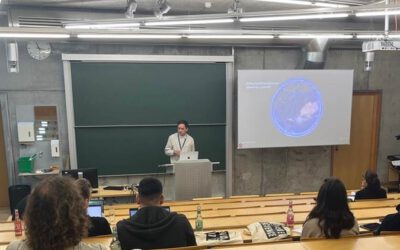
On Thursday 22nd of May, our Department Chair, Prof. Hannes Taubenböck was honored to welcome Prof. Dr. Monika Kuffer from ITC Enschede for a guest presentation at the Earth Observation Center (EOC) of the German Aerospace Center (DLR) in Oberpfaffenhofen. We were very happy to welcome so many attendees to the exciting presentation titled “Urban Inequalities from Space – Towards Grounded GeoAI “.
Here is the abstract of the presentation: Rapid urbanization poses significant housing and environmental challenges, increased by climate change. Spatial inequalities are especially acute in cities of Low- and Middle-Income Countries (LMICs). Addressing these issues requires high-resolution, timely, and locally specific data. Integrating Earth Observation (EO), Artificial Intelligence (AI), and local stakeholder input is essential for informed, context-sensitive adaptation strategies. This presentation explores methodological advances combining EO, AI, and Citizen Science to support evidence-based policymaking aligned with the Sustainable Development Goals (SDGs). It emphasizes the need for grounded data on urban deprivation and climate risks, such as floods and heatwaves, considering social, economic, and environmental dimensions to guide effective local adaptation. However, key challenges hinder EO’s full potential: (a) limited availability of in situ data, (b) a geographic knowledge divide with often a Global North research, and (c) insufficient inclusion of local communities in mapping processes. Many EO-based applications lack stakeholder collaboration, reducing their relevance and impact. This presentation highlights advances in grounded GeoAI for measuring urban inequalities across various dimensions, showcasing novel datasets, societal relevance, and innovations that deliver actionable, locally meaningful insights to support sustainable and inclusive urban development.
We have a long-standing scientific co-operation with Monika Kuffer. We have worked with her on the topic of poverty, slums and earth observation, published papers and special issues together and she is also Chair of the Joint Urban Remote Sensing Event (jurse.org) together with our Professor Hannes Taubenböck.
Joint works are e.g.:
- Misperceptions of predominant slum locations? Spatial analysis of slum locations in terms of topography based on earth observation data. https://www.mdpi.com/2072-4292/12/15/2474
- Capturing the urban divide in nighttime light images from the International Space Station. https://ieeexplore.ieee.org/document/8362725
- Detection of Unmonitored Graveyards in VHR Satellite Data Using Fully Convolutional Networks. https://link.springer.com/chapter/10.1007/978-3-031-49183-2_9
- Mapping the morphology of urban deprivation: The role of remote sensing for developing a global slum repository. https://onlinelibrary.wiley.com/doi/10.1002/9781119625865.ch14
- Spatial patterns of slums: Comparing African and Asian cities. https://ieeexplore.ieee.org/document/7924587
- Jointly edited Special Issue in IEEE JSTARS titled “Exploring the Potential of Urban Remote Sensing” https://ieeexplore.ieee.org/document/10960404
- Jointly edited Special Issue in IEEE JSTARS titled “Paving the Way for the Future of Urban Remote Sensing” https://ieeexplore.ieee.org/document/9321233
Her work relates very much to our works in the domain of Earth Observation, poverty, slums and informal settlements. For more information please see here: https://remote-sensing.org/a-decade-of-research-on-poverty-slums-and-informal-settlements-with-remote-sensing/