From raging wildfires to devastating floods, natural hazards are becoming more frequent, more intense, and harder to predict. In this rapidly changing world, the ability to understand disasters as they unfold is no longer optional—it’s essential. This is exactly where the EAGLE MSc course “Natural Hazards – Rapid Mapping and Analysis by Means of Earth Observation,” taught by Dr. Simon Plank, comes in.
This course places students at the intersection of cutting-edge technology and real-world disaster response, showing how Earth Observation (EO) can be transformed into actionable information when it matters most.
Seeing the Earth Through Multiple Lenses
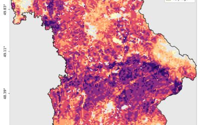
A key strength of the course is its broad yet practical introduction to Earth Observation techniques used in disaster monitoring. Students explore how different sensors reveal different aspects of natural hazards:
-
Thermal Remote Sensing helps detect heat anomalies, making it invaluable for tracking active volcanoes and monitoring wildfire dynamics.
-
Optical Remote Sensing provides high-resolution, visually intuitive imagery that supports land-use analysis and post-disaster damage assessments.
-
Synthetic Aperture Radar (SAR) stands out for its ability to “see” through clouds and darkness—an essential advantage when monitoring floods, landslides, or earthquakes under challenging conditions.
-
Polarimetric and Interferometric SAR (Pol/InSAR) takes things a step further by detecting subtle ground movements, offering critical insights into surface deformation caused by earthquakes or volcanic activity.
Together, these techniques demonstrate how no single sensor tells the whole story—but when combined, they create a powerful toolkit for hazard analysis.
Learning by Doing: From Theory to Practice
Rather than stopping at theory, the course strongly emphasizes hands-on experience. Using professional tools such as SNAP (Sentinel Application Platform) and Google Earth Engine, students work through practical exercises inspired by real disaster scenarios. These short, focused tasks help bridge the gap between academic knowledge and operational skills, preparing students for real-world applications in research, public authorities, or industry.
Real Hazards, Real Applications
Throughout the semester, students apply EO techniques to a wide range of natural hazards, including:
-
Volcanoes – monitoring activity and interpreting eruption signals
-
Landslides – identifying unstable slopes and assessing potential impacts
-
Earthquakes – mapping ground deformation and damage patterns
-
Tsunamis – rapidly delineating affected coastal areas
-
Storms and Floods – tracking extreme weather events and flood extents
-
Wildfires – mapping burn scars and evaluating fire progression
Each example reinforces how EO-based rapid mapping supports faster, more informed decision-making during emergencies.
Why This Course Makes a Difference
As climate change continues to amplify natural hazards worldwide, technical expertise alone is not enough. This course encourages students to think critically about the societal and economic consequences of disasters and the responsibility that comes with interpreting and communicating EO data.
Under the guidance of Dr. Simon Plank, students don’t just learn how to process satellite data—they learn how to use it meaningfully, ethically, and effectively in high-pressure situations.
Be Part of the Solution
For anyone passionate about disaster risk reduction, environmental monitoring, or the practical use of satellite data, this course is a cornerstone of the EAGLE MSc program. It equips students with the skills, confidence, and perspective needed to face some of today’s most urgent global challenges.
To learn more about the EAGLE MSc program and stay up to date on upcoming courses, visit www.eagle-science.org and discover how Earth Observation can help build a more resilient future.