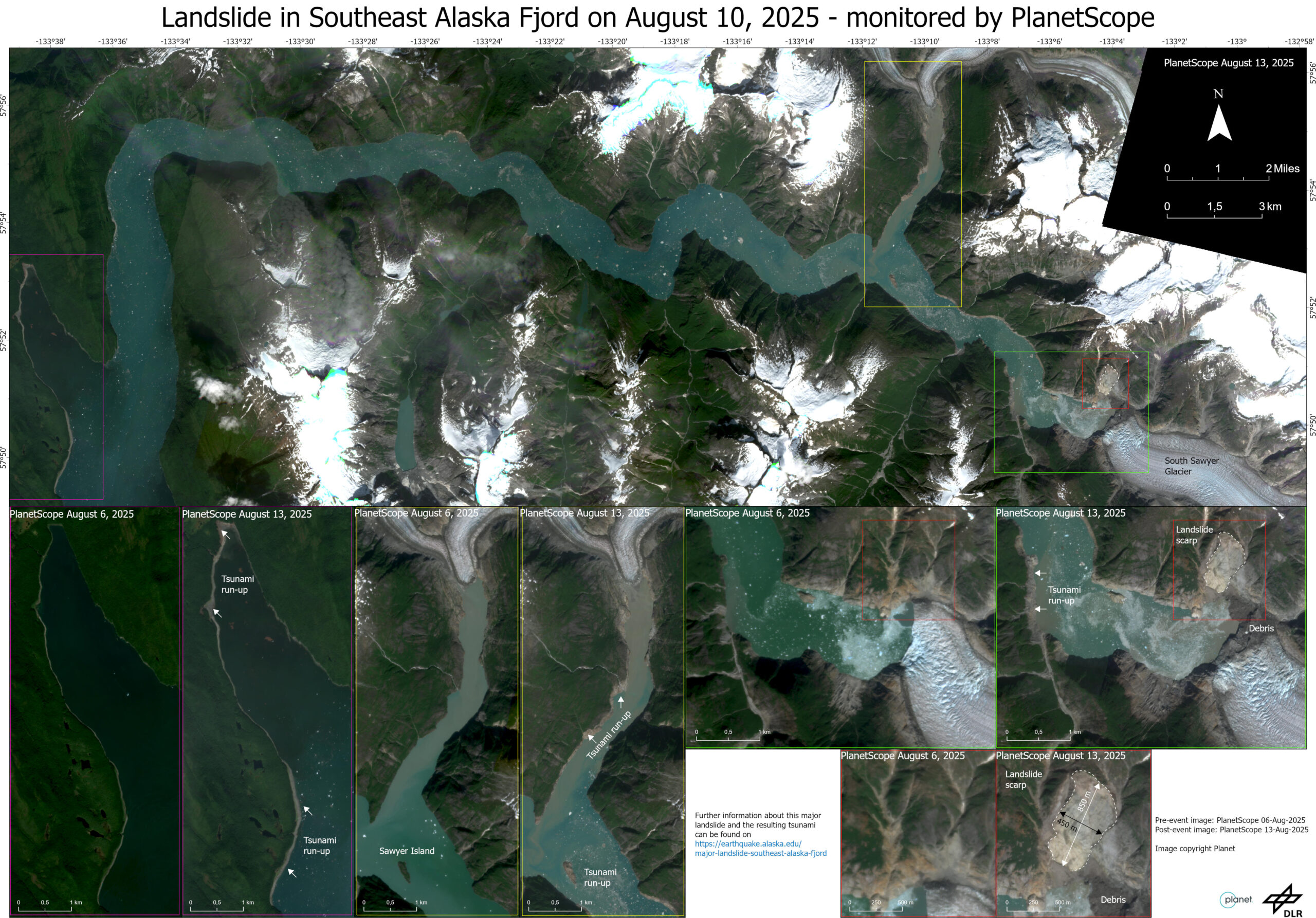
Massive landslide in Alaska triggered tsunami – supporting the Alaska Earthquake Center
On August 10, 2025, a massive landslide occurred near South Sawyer Glacier in Tracy Arm fjord in Southeast Alaska. The landslide caused a big tsunami with a runup height up to 470 m on the opposing fjord wall and still a height of up to 30 m in a distance of about 6 km down the fjord.
Our habilitation candidate and guest lecturer from DLR Dr. Simon Plank supported colleagues of the Alaska Earthquake Center by analyzing pre- and post-event PlanetScope satellite imagery to map the landslide scarp and runup areas affected by the tsunami. More details on this massive tsunamigenic landslide and the satellites maps can be found on https://earthquake.alaska.edu/event/025a7d7cil/detail as well as in diverse social media posts of the Alaska Earthquake Center:
https://www.instagram.com/akearthquake/p/DNXFIQYtrfQ/
https://x.com/AKearthquake/status/1956196709840650393