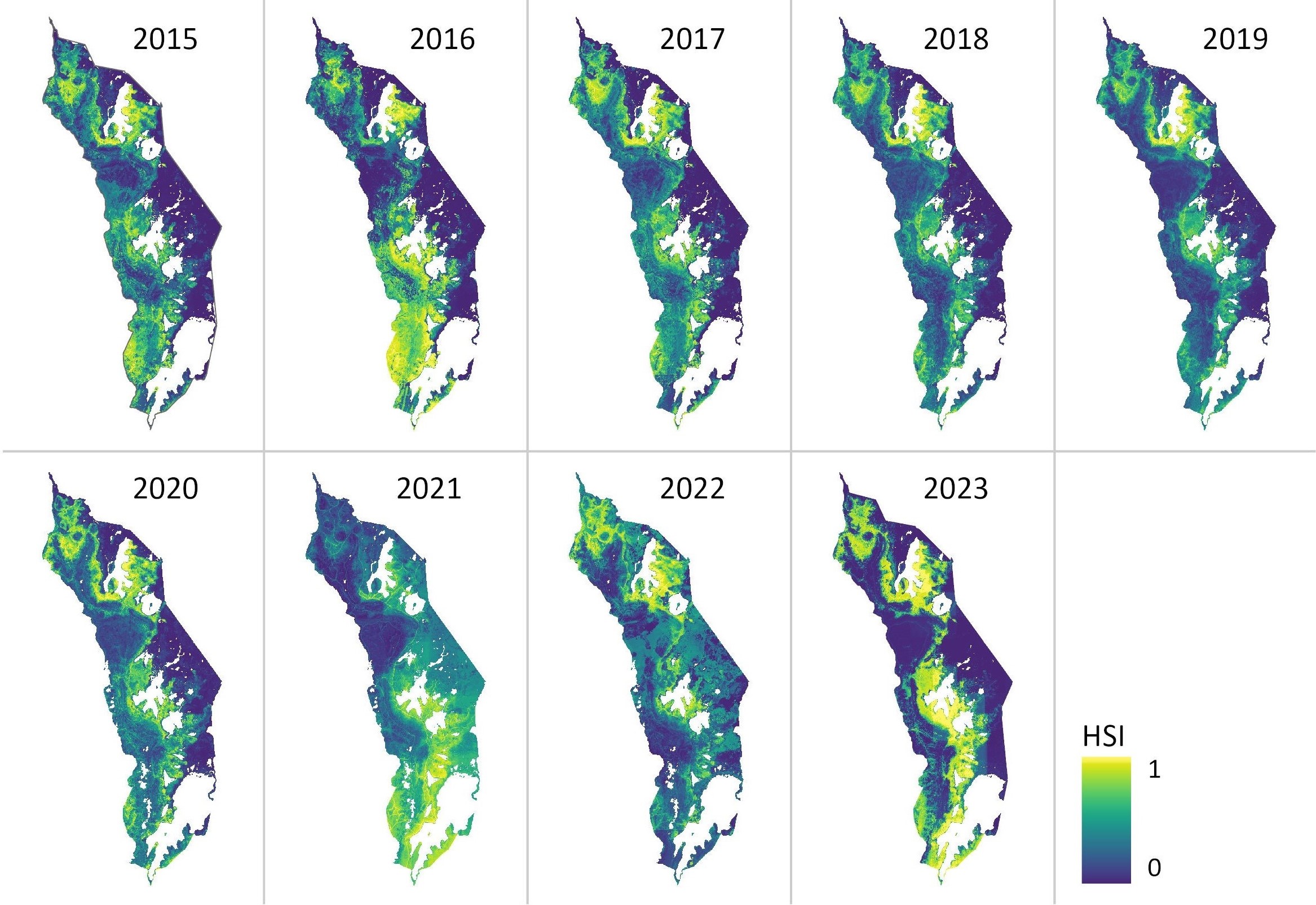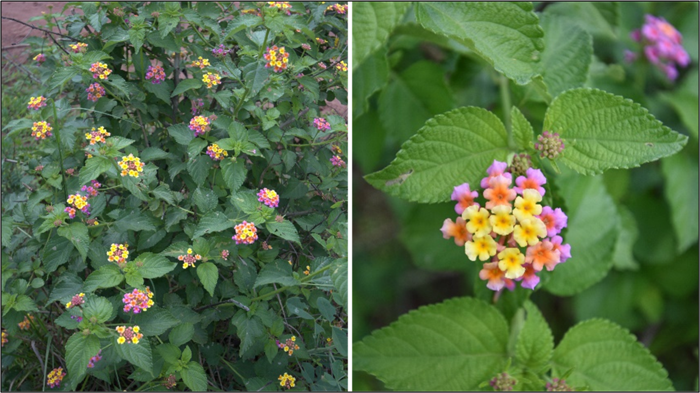

A new publication by EORC members Lilly Schell, Insa Otte, Sarah Schönbrodt-Stitt and Konstantin Müller, was just published in the Journal Frontiers in Plant Science. Their study, “Synergistic use of satellite, legacy, and in situ data to predict spatio-temporal patterns of the invasive Lantana camara in a savannah ecosystem”, explores how advanced remote sensing and machine learning can help to model the spread of one of the world’s most problematic invasive species. Focusing on Rwanda’s Akagera National Park, the research highlights key environmental and human factors that drive invasions and provides insights for more effective conservation strategies.
Here is the abstract of the paper:
Modeling species distributions is critical for managing invasive alien species, as reliable information on habitat suitability is essential for effective conservation and rehabilitation strategies. In this study, we modeled the suitable habitat and potential distribution of the notorious invader Lantana camara in the Akagera National Park (1,122 km²), a savannah ecosystem in Rwanda. Spatiotemporal patterns of Lantana camara from 2015 to 2023 were predicted at a 30-m spatial resolution using a presence-only species distribution model, implementing a Random Forest classification algorithm and set up in the Google Earth Engine. The model incorporated Sentinel-1 SAR, Sentinel-2 multispectral data, anthropogenic predictors, and in situ presence data of Lantana camara. A maximum of 33% of the study area was predicted as a suitable Lantana camara habitat in 2023, with higher vulnerability in the central, northern, and southern Akagera National Park. The change detection analysis revealed an increase in habitat suitability in the northeastern sector and a decrease in the southwestern part of the park over the study period. The model’s predictive performance was robust, with AUCROC values ranging from 0.93 to 0.98 and AUCPR values ranging from 0.79 to 0.94. Key factors influencing Lantana camara habitat suitability in the study area are the road network, the elevation, and soil nitrogen levels. Additionally, the red edge, shortwave, and near-infrared spectral bands were identified as essential predictors, highlighting the efficacy of combining remote sensing and anthropogenic data with machine learning techniques to predict invasive species distributions. These findings provide valuable guidance for developing effective conservation strategies to protect savannah ecosystems and mitigate the spread of Lantana camara in the future.
Link to the full paper: https://www.frontiersin.org/journals/plant-science/articles/10.3389/fpls.2025.1593110/full