Master Defense: Comparing the suitability of remote sensing and wildlife camera time series for deriving phenological metrics of understory vegetation in temperate forests of Upper Franconia, Bavaria

Master Defense: Comparing the suitability of remote sensing and wildlife camera time series for deriving phenological metrics of understory vegetation in temperate forests of Upper Franconia, Bavaria

September 12, 2024

On September 18, Sarah Schneider will present her master thesis “Comparing the suitability of remote sensing and wildlife camera time series for deriving phenological metrics of understory vegetation in temperate forests of Upper Franconia, Bavaria” at 14:00 in seminar room 3, John-Skilton-Str. 4a.
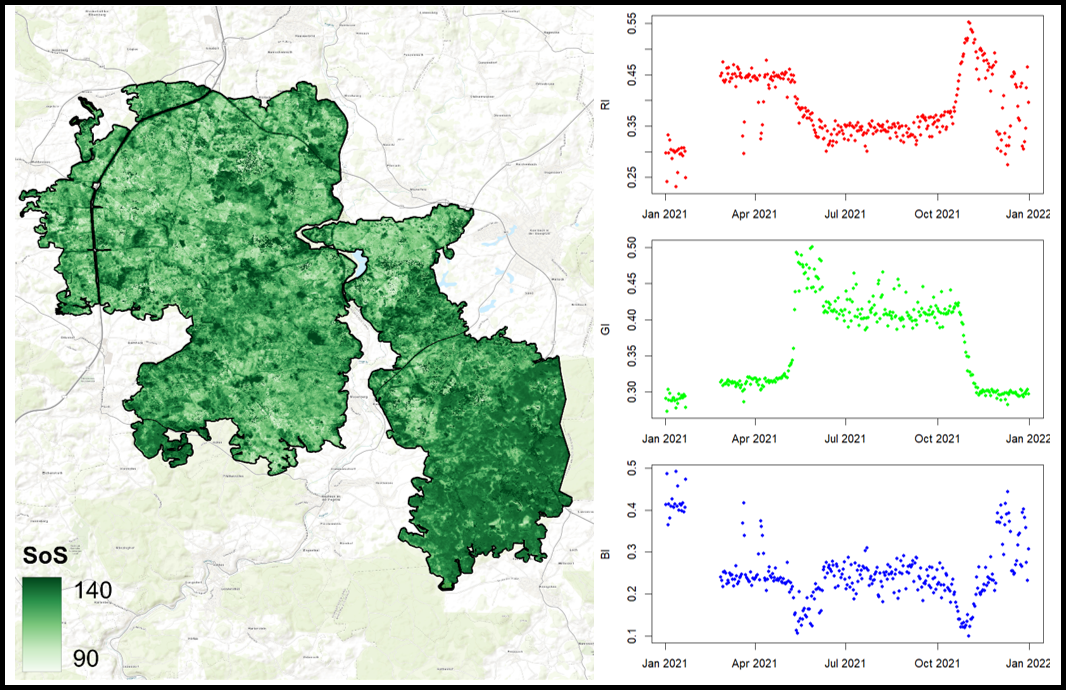
From the abstract: The thesis explores the use of sensor harmonization between Sentinel-2 and Landsat data. This is used to monitor the phenological dynamics of understory vegetation in temperate deciduous forests in Upper Franconia, Bavaria, Germany. The understory is a diverse and important layer within forest ecosystems and plays a significant role in nutrient cycling, species composition, and habitat provision. Despite its significance, the understorey has gotten very little attention in phenological study, with the majority of studies concentrating on the canopy layer. Changing environmental conditions, such as light availability and the effects of climate change, make it crucial to better understand the phenological patterns of understory vegetation. The research aims to evaluate how effectively harmonized multispectral remote sensing data can capture phenological patterns in understory vegetation and compare these observations to ground-based wildlife camera data. The goal is to assess the reliability of remote sensing for tracking seasonal changes in understory vegetation and understand how these tools can complement ground observation methods.
1st supervisor: Prof. Dr. Tobias Ullmann
2nd (external) supervisor: Dr. Hendrik Edelhoff (LWF)

you may also like:

Project meeting NetCDA

Project meeting NetCDA

The first annual NetCDA project meeting took place in Würzburg on November 21st, 2024. Together with all German and West African partners from the West African Science Service Centre on Climate Change and Land Use (WASCAL), we have laid the foundation for our future...

The EORC can also be found on bluesky

The EORC can also be found on bluesky

We are active on various social media channels but in the last weeks we monitored a very strong increase of scientists joining bluesky and following our activities on that platform. Therefore we decided to be more active on bluesky and post regular news about our...

Blender GIS introduction

Blender GIS introduction

Within out EAGLE Earth Observation M.Sc. we also cover software applications which might not be used on a regular basis within our field of research but are sometimes highly useful to display our spatial data in a visually appealing way - and also potentially provides...

EAGLE presentation by Gökçe Yağmur Budak

EAGLE presentation by Gökçe Yağmur Budak

On November 26, 2024, Gökçe Yağmur Budak will present her internship results on " Leveraging Data-Driven Approaches for Seismic Risk Assessment in Istanbul " at 12:30 in seminar room 3, John-Skilton-Str. 4a. From the abstract: This internship aims to create time...

JURSE – deadline for paper submission extended

JURSE – deadline for paper submission extended

JURSE - Joint Urban Remote Sensing Event   The 17th International Conference on Joint Urban Remote Sensing (JURSE), organized by Higher School of Communication of Tunis (SUP'COM) will take place in Tunisia from 4 to 7 May 2025. https://2025.ieee-jurse.org/ ;...