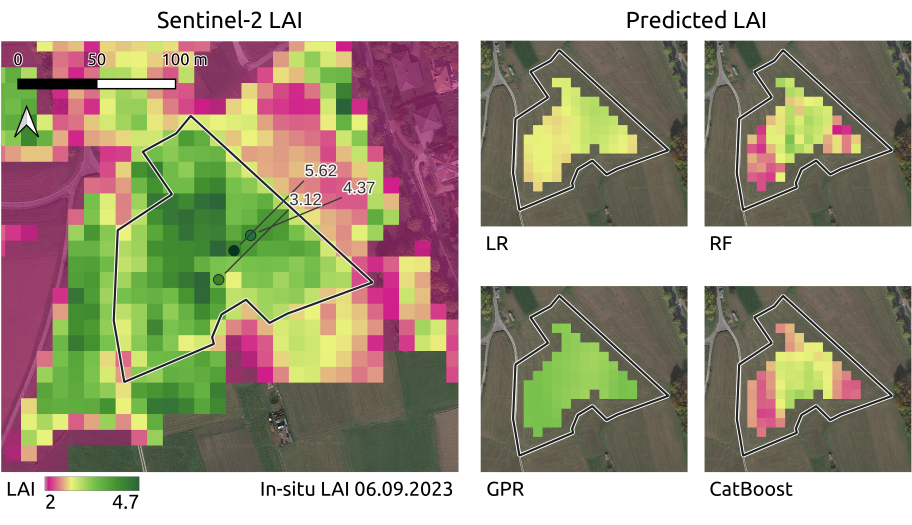
From the abstract: Alpine grasslands are crucial ecosystem providers and one of the most threatened terrestrial habitats in the EU. Extreme heat and drought events become more frequent with climate change and lead to yield losses, making continuous, large-scale monitoring of grassland essential. Remote sensing derived Leaf Area Index (LAI) is a key biophysical parameter for grassland yield. However, LAI from optical sensors like Sentinel-2 (S2) is affected by clouds which cause gaps in the time series. Cloud-free LAI can be obtained by data fusion with cloud-penetrating Sentinel-1 (S1) SAR data. This thesis investigates the potential of S1 together with auxiliary predictors (day of the year, precipitation, temperature, and altitudinal class) in a data fusion approach for the spatial gap-filling of LAI from S2. Different machine learning algorithms, including the Gaussian Process Regressor (GPR), Random Forest Regressor (RF), CatBoost, and the multiple-variable Linear Regressor (LR) as benchmark, are trained and validated over Alpine grasslands in North-Eastern Italy for the years 2020-2022. They are tested against in-situ and S2 LAI measurements over eight parcels and unseen test meadows in 2023. In the validation, RF performs best (R²=0.70, RMSE=0.97), though the test reveals that the models are not robust and perform poorly. Here, CatBoost is the best-suited model in achieving R²=0.16 and RMSE=1.34 against S2 LAI. The GPR performs second-best (R²=0.11, RMSE=1.37), surpassing the RF and LR. The test against the in-situ LAI states strong underestimations with high RMSE for all models. All models rely on auxiliary predictors which discloses that S1 is difficult to interpret. The low performance is accounted to the models relying too strongly on these features as the management activities cannot be identified properly. In conclusion, S1, especially using CatBoost or GPR, has a large potential to accurately fill the cloud-related gaps in S2 LAI over Alpine grasslands. In the future, the models should be based more on S1, for example using polarimetric decomposition of the SAR signal to enhance its interpretability without auxiliary predictors. Alternative models like the Multioutput Gaussian Process together with active learning should be investigated, especially with only one active S1 sensor in orbit.
1st supervisor: Prof. Dr. Tobias Ullmann
2nd (external) supervisor: Dr. Mariapina Castelli, EURAC Research


