 A new paper on cropland abandonment in Central Asia was published in Applied Geography in the context of the LaVaCCA Project.
In many regions worldwide, cropland abandonment is growing, which has strong and known environmental and socio-economic consequences. Yet, spatially explicit information on the spatial pattern of abandonment is sparse, particularly in post-Soviet countries of Central Asia. When thriving reaching for key Millennium Development Goals such as food security and poverty reduction, the issue of cropland abandonment is critical and therefore must be monitored and limited, or land use transformed into an alternative one. Central Asia experienced large changes of its agricultural system after the collapse of the Soviet Union in 1991. Land degradation, which started already before independence, and cropland abandonment is growing in extent, but their spatial pattern remains ill-understood.
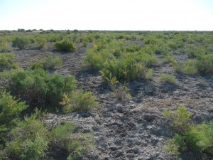
 The objective of this study was to map and analyse agricultural land use in the irrigated areas of Kyzyl-Orda, southern Kazakhstan, Central Asia. For mapping land use and identifying abandoned agricultural land, an object-based classification approach was applied. Random forest (RF) and support vector machines (SVM) algorithms permitted classifying Landsat and RapidEye data from 2009 to 2014. Overlaying these maps with information about irrigated land parcels, installed during the Soviet period, allowed indicating abandoned fields. Fusing the results of the two approaches, RF and SVM, resulted in classification accuracies of up to 97%. This was statistically significantly higher than with RF or SVM alone. Through the analysis of the land use trajectories, abandoned agricultural fields and a clear indication of abandoned land were identified on almost 50% of all fields in Kyzyl-Orda with an accuracy of approximately 80%. The outputs of this study may provide valuable information for planners, policy- and decision-makers to support better-informed decision-making like reducing possible environmental impacts of land abandonment, or identifying areas for sustainable intensification or re-cultivation.


