


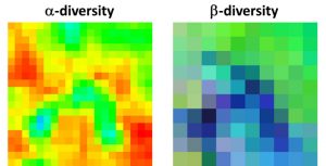
 Another article lead by Duccio Rocchini just got published in Methods in Ecology and Evolution titled “Measuring β‐diversity by remote sensing: A challenge for biodiversity monitoring”. From the abstract: “Biodiversity includes multiscalar and multitemporal structures and processes, with different levels of functional organization, from genetic to ecosystemic levels. One of the mostly used methods to infer biodiversity is based on taxonomic approaches and community ecology theories. However, gathering extensive data in the field is difficult due to logistic problems, especially when aiming at modelling biodiversity changes in space and time, which assumes statistically sound sampling schemes. In this context, airborne or satellite remote sensing allows information to be gathered over wide areas in a reasonable time.” read more here
Rocchini D, Luque S, Pettorelli N, et al. Measuring β‐diversity by remote sensing: A challenge for biodiversity monitoring. Methods Ecol Evol. 2018;9:1787–1798. https://doi.org/10.1111/2041-210X.12941


