A new article has been published by Christabel Ansah about her Msc thesis topic together with her supervisor team and the National Oil Spill Detection and Response Agency (NOSDRA) in Nigeria. This work has been performed in the frame work of WASCAL-DE-Coop. She is now doing her PhD at University of Osnabrück,
From the abstract:
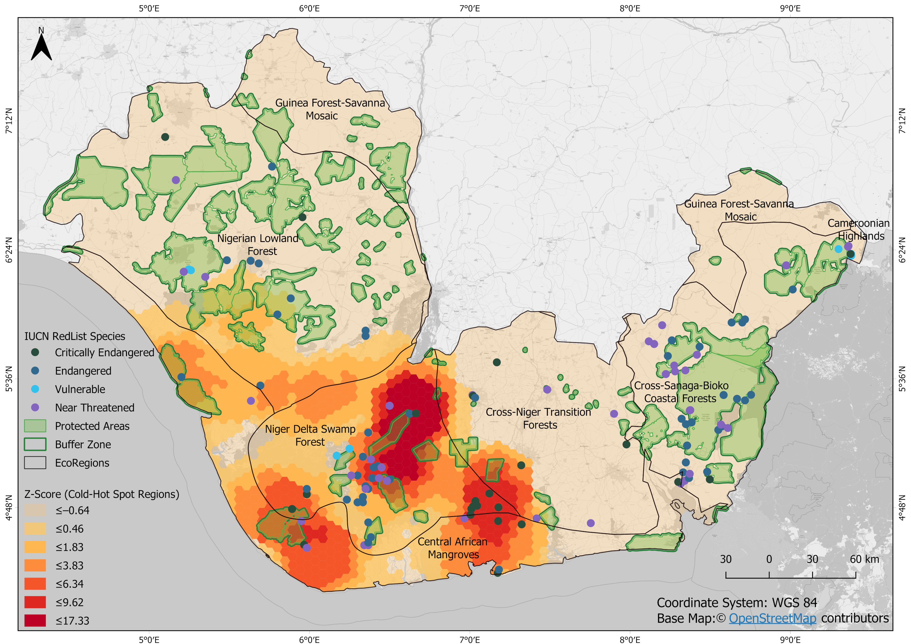
The Niger Delta belongs to the largest swamp and mangrove forests in the world hosting many endemic and endangered species. Therefore, its conservation should be of highest priority. However, the Niger Delta is confronted with overexploitation, deforestation and pollution to a large extent. In particular, oil spills threaten the biodiversity, ecosystem services and local people. Remote sensing can support the detection of spills and their potential impact when accessibility on site is difficult. We tested different vegetation indices to assess the impact of oil spills on the land cover as well as to detect accumulations (hotspots) of oil spills. We further identified which species, land cover types and protected areas could be threatened in the Niger Delta due to oil spills. The results showed that the Enhanced Vegetation Index, the Normalized Difference Vegetation Index and the Soil Adjusted Vegetation Index were more sensitive to the effects of oil spills on different vegetation cover than other tested vegetation indices. Forest cover was the most affected land-cover type and oil spills also occurred in protected areas. Threatened species are inhabiting the Niger Delta Swamp Forest and the Central African Mangroves that were mainly affected by oil spills and, therefore, strong conservation measures are needed even though security issues hamper the monitoring and control.


