new publication on landslide vulnerability

new publication on landslide vulnerability

November 9, 2022

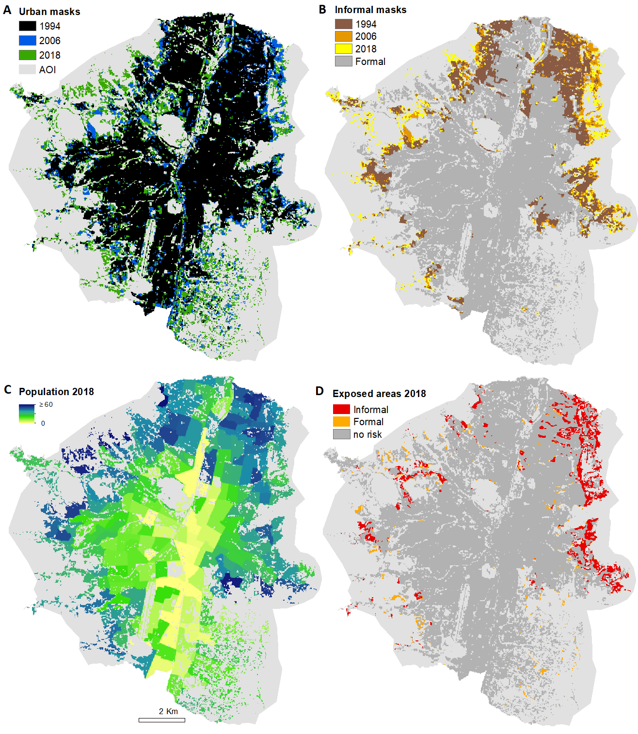
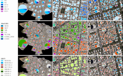
A new paper on multitemporal landslide exposure and vulnerability assessment was just published by Marlene Kühnl, Marta Sapena, Michael Wurm, Christian Geiß & Hannes Taubenböck.

Abstract: Landslides are often deadly natural events. Steep slopes and certain loose soil types are predestined areas for them. Moreover, in the context of climate change, extreme weather events such as heavy rainfall, which often trigger landslides, are becoming even more likely. While all this is well known, it, therefore, stands to reason that this knowledge will lead to the avoidance of these risks. On the other hand, however, there are highly dynamic urbanization processes that often overtake formal urban planning processes by rising population figures and areal expansion. In the course of these processes, economically deprived population groups often have no other option than to informally build on high-risk areas. Against these backgrounds, we systematically examine in this study how these risks

develop over a 24-year period from 1994 to 2018 taking into account three time steps, with respect to the citywide exposure and in particular with respect to different social groups. For this purpose, we use heterogeneous input data from remote sensing, landslide hazard maps, and census data. Our case study is the city of Medellín in Colombia. We develop and apply a set of methods integrating the heterogenous data sets to map, quantify and monitor exposure and social vulnerability at a fine spatial granularity. Our results document first of all the highly dynamic growth in total population and urban areas. However, our results reveal that the city’s expansion is socially unevenly distributed. People of higher vulnerability proxied by informal settlements are found to settle in considerably higher shares

of areas exposed to landslides. This study proposes a methodological setup that allows for monitoring exposure and social vulnerability over long time spans at a fine spatial resolution, allows to bring inequality into the spotlight, and provides decision-makers with better information to develop socially responsible policies.

read the full article here:

https://link.springer.com/article/10.1007/s11069-022-05679-z

you may also like:

PhD position: Earth Observation of drought and fire impacts

PhD position: Earth Observation of drought and fire impacts

Job Announcement: PhD Position on EO research of Drought, Fire and Vegetation in Kruger National Park, South Africa Position: PhD ResearcherStudy Area: Kruger National Park, South AfricaApplication Deadline: until position is filledStart Date: as soon as possible...

Door picture at our newer wing

Door picture at our newer wing

To enhance navigation in our new office wing, we've introduced playful and distinctive imagery featuring our logo, alongside clever animal representations for the North and South wings. The penguin and polar bear not only add a touch of whimsy but also help our team...

Presentation at Wiener Planungswerkstatt

Presentation at Wiener Planungswerkstatt

On 16 January 2025, an evening event on the topic of urban development took place at the "Wiener Planungswerkstatt" in Vienna – see here: https://www.linkedin.com/events/wieundwowirwohnen-wollen-soziol7271805797850861569/about/. The event was organized and...

Visit to Seestadt Aspern in Vienna

Visit to Seestadt Aspern in Vienna

Vienna's Seestadt Aspern is one of the current largest urban development areas in Europe. By the 2030s, a brand new city will be fully completed in the east of Vienna. Living space for more than 25,000 people and over 20,000 jobs, education, and formation...

Exchange with colleagues from AIT Austrian Institute of Technology

Exchange with colleagues from AIT Austrian Institute of Technology

On 16 January 2025, Ariane Droin, Henri Debray and Hannes Taubenböck from EORC and the EOC of DLR were invited to the AIT Austrian Institute of Technology GmbH in Vienna as part of the UrbanSky project. The Urban Sky research project is carrying out a needs and...

Empowering Students with SAGA GIS for Environmental Applications

Empowering Students with SAGA GIS for Environmental Applications

At EAGLE Earth Observation, we are committed to equipping our students with the tools and knowledge needed to excel in the field of environmental science. As part of this effort, our students are exploring the power of various scientific open-source software packages...