New publication on the importance of semiformal transport in urban areas
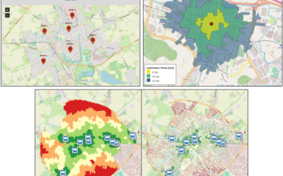
Researchers from the Earth Observation Center (EOC) of the German Aerospace Center (DLR) in Oberpfaffenhofen, the Institute of Transport Research of the DLR in Berlin and our Earth Observation Research Cluster (EORC) of the University of Würzburg teamed up for a study on the importance of semiformal transport in addition to formally organized public transport. The paper titled “Does formal public transport serve the city well? The importance of semiformal transport for the accessibility in Medellín, Colombia” was just published in the journal PLoS ONE by Dorothee Stiller, Michael Wurm, Marta Sapena, Simon Nieland, Stefan Dech and Hannes Taubenböck.
Here is the abstract of the paper: Accessibility to public transport is a fundamental component of connecting individuals to urban services. Guided by the UN Habitat Sustainable Development Goal 11.2, which aims to ensure accessible, safe, affordable, and sustainable transport systems for all, our study focuses specifically on accessibility as a key dimension of achieving this goal and its implications for social and spatial equity. In this study, we employ the walking distance indicator proposed by the responsible working group of UN Habitat to calculate accessibility to public transport. Because underlying population data are an essential parameter for the indicator, we compare three distinct population datasets – cadaster-based population data, remote sensing-based population data, and a global dataset – to investigate spatial variations in accessibility across the city of Medellín, Colombia. Furthermore, we examine the impact of both formal public transport and the local semiformal minibus system (paratransit), analyzing differences across formal and informal settlement types of the city, as well as the influence of socio-economic factors. Our findings suggest that remote sensing based population data can serve as a valuable data source, albeit with limitations for global population data. Particularly, our results highlight the significance of the semiformal local minibus system in enhancing accessibility to public transport, despite ongoing expansions of the metro system by responsible authorities, which have led to considerable improvements in accessibility. Notably, we observe that residents with lower socio-economic status and those living in informal settlements experience longer walking distances to public transport stops, highlighting spatial and socio-economic disparities in accessibility. Overall, our study underscores the complex interplay between transport infrastructure, socio-economic factors, and urban development, highlighting the need for targeted interventions to address spatial and socio-economic disparities in public transport accessibility.
Here is the link to the full paper: https://journals.plos.org/plosone/article?id=10.1371/journal.pone.0321691
This work complements other work on inequality, poverty, informal settlements and slums – for more information please see here: https://remote-sensing.org/a-decade-of-research-on-poverty-slums-and-informal-settlements-with-remote-sensing/