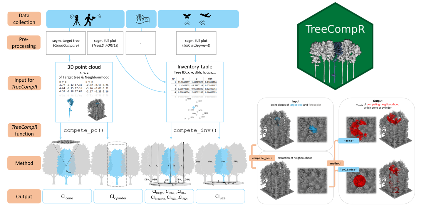
One of our staff members of the Earth Observation Research Cluster (EORC), Julia Rieder, in cooperation with colleagues from TU Dresden, University of Göttingen and HSWT, just published a paper titled “TreeCompR: Tree competition indices for inventory data and 3D point clouds” in Methods in Ecology and Evolution.
From the abstract:
- In times of more frequent global change-type droughts and associated tree mortality events, competition release is one silvicultural measure discussed to have an impact on the resilience of managed forest stands. Understanding how trees compete with each other is therefore crucial, but different measurement options and competition indices (CI) leave users with a difficult choice, as no single competition index has proven universally superior.
- To help users with the choice and computation of appropriate indices, we present the open-source TreeCompR package, which handles 3D point clouds and classical forest inventory data, enabling the calculation of both innovative point cloud-based indices and traditional distance-dependent indices. It serves as a centralized platform for exploring and comparing different CIs, allowing users to test and select the most suitable CI for their specific research questions within a common interface.
- To evaluate the package, we used TreeCompR to quantify the competition situation of 307 European beech trees from 13 sites in Central Europe. Based on this dataset, we discuss the interpretation, comparability and sensitivity of the different indices to their parameterization and identify possible sources of uncertainty and ways to minimize them.
- The compatibility of TreeCompR with different data formats and different data collection methods makes it accessible and useful for a wide range of users, specifically ecologists and foresters. Due to the flexibility in the choice of input formats as well as the emphasis on tidy, well-structured output, our package can easily be integrated into existing data-analysis workflows both for 3D point cloud and classical forest inventory data.
Read the full text: https://doi.org/10.1111/2041-210X.14414
Try out the R package: https://juliarieder.github.io/TreeCompR/

