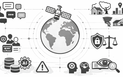
Wondering how remote sensing and earth observation contribute to evidence-based policy-making? Pondering about existing hurdles and requirements of stakeholders at the science-policy interface? So are we! Around 20 minutes of your time will help us in finding out more. Please join our online-survey Spaceborne Remote Sensing at the Science-Policy Interface.
Alexandra Bell and Sarah Schönbrodt-Stitt from the Department of Remote Sensing at the University of Würzburg are working on dissemination strategies of scientific evidence at the science-policy interface. To gain more insights into existing hurdles and potential opportunities to strengthen the collaboration at the science-policy interface, they have developed the online survey “Spaceborne Remote Sensing at the Science-Policy Interface”. A focus is placed on spaceborne (i.e., satellite-based) remote sensing as an increasingly valued EO tool for providing scientific evidence for evidence-based policy-making, and the requirements of different stakeholders (i.e., academics and researchers, people working at intermediary organizations, and policy-makers) within this field.
Their work contributes to the project “WASCAL-DE-Coop“, which is funded by the German Federal Ministry of Education and Research (BMBF) within the framework of the Strategy “Research for Sustainability” (FONA). WASCAL-DE-Coop contributes to climate and land-use change research in West African countries. However, through the development of the above web-based survey and your participation, Alexandra and Sarah aim to contribute to a broader, more inclusive (i.e., geographically not restricted and covering different environmental-related disciplines) view and understanding of this field and research topic.
We would be delighted if you would participate in our online survey. The survey will be kept active until 31st of January 2022.