Phd postion on Earth Observation for Megacity Research
Monitoring status and changes of the earth is essential for a sustainable management of our limited natural resources. A special focus lies on urban areas, where a large portion of the global population lives. Megacities, the largest agglomerations on our planet, are a crucial environments for understanding challenges and needs in current and future urbanization processes.
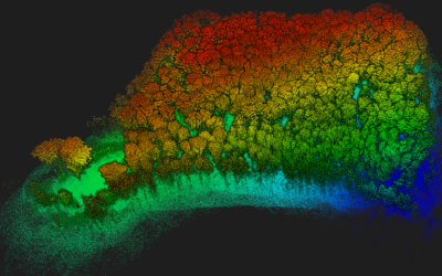
Earth Observation data from satellites and related analysis techniques are perfect tools to describe the physical landscapes of the large, complex structures of megacities. However, the physical appearance only indirectly tells about the perceptions of space by the inhabitants. Information from people (e.g. by social networks or field surveys) are crucial to understand the functioning of spaces. The synergistic analysis of remotely sensed and social media data have potential in understand relationships. This requires the development of robust methods, which are applicable across cities.
This project ought to investigate the usefulness of multi-sensor remote sensing data in combination with social media as well as administrative data for characterizing challenges of people and urban planners in megacities. Especially the potential of multi-sensor approaches as well as time-series analysis should be explored. Robust transferable methods for assessing the status quo and the changes over time in megacities should be developed. Candidates are expected to pursue a PhD degree within this project.
Requirements:
We look for a candidate holding a M.Sc. degree with expertise in remote sensing, spatial statistics, and handling of various sources of data. A sound knowledge in remote sensing software, geographic information systems (GIS) and programming (e. g., Python, R) is required. The ability to work independently, organizational skills, high motivation and the willingness to work within an interdisciplinary team of collaborators are essential.
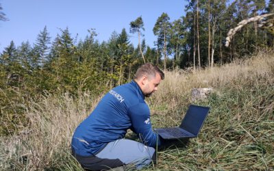
Necessary is the ability to undertake independent field work and to communicate and collaborate with different stakeholders. Proficiency in the English language, communication skills, and the capability to write research reports and peer-reviewed publications are further required.
Working environment: We offer a stimulating research environment within an interdisciplinary, dynamic research team at the Remote Sensing Department of the Institute of Geography and Geology at the University of Würzburg in close collaboration with the German Remote Sensing Data Center of DLR. The position covers 3 years and is expected to start in 2022, with salary according to TVöD (50%).
Applicants are invited to submit their applications via email including a cover letter, CV and all necessary certificates to l-geofernerkundung@uni-wuerzburg.de before Oct. 31st 2021. The position is to be filled by spring 2022 and offered for a fixed term of 3 years.
The University of Würzburg is an equal opportunity employer, determined to increase the proportion of women in successful scientific careers, and particularly encourages them to apply. Preference will be given to disabled applicants with the same qualifications. Inquiries or questions should be directed to:
Contact: Dr. Martin Wegmann, Department Manager l-geofernerkundung@uni-wuerzburg.de