Real-Time Global Computation of the Solar Position in Google Earth Engine

Real-Time Global Computation of the Solar Position in Google Earth Engine

October 11, 2022

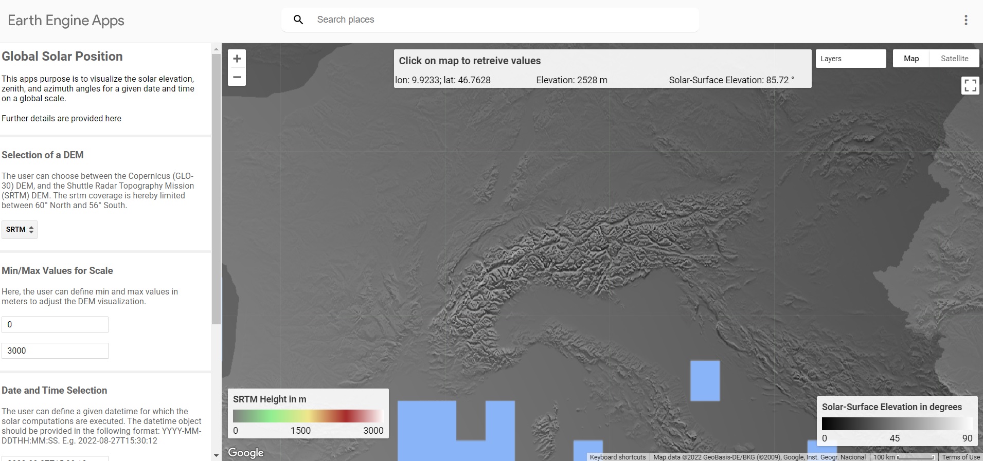
Description: Information about the solar position at a given date and time is crucial for e.g. photovoltaic systems and numerous environmental analyses. For this purpose I created the “GlobalSolarPosition” module which enables global computation and visualization of solar position, both with and without respect to the surface slope and aspect in Google Earth Engine. Users can either incorperate the respective functions in their scripts or use the interactive GEE Application.

The calculations of the solar zenith and azimuth angles are based on the following equations. The angles are computed for a given local time with respect to the present time zone based on the Natural Earth time zones dataset.

Access: The code to the functions, example scripts, as well as an interactive Google Earth Engine Application can be accessed via the GlobalSolarPosition GitHub repository.

Citation: Philipp, M. (2022): GobalSolarPosition V.1.0. Zenodo. https://doi.org/10.5281/zenodo.7139847.

you may also like:

Bridging Scales: How Radar Satellites supports Crop Monitoring

Bridging Scales: How Radar Satellites supports Crop Monitoring

In an era of climate uncertainty and increasing pressure on agricultural systems, understanding how crops grow and respond to environmental stress is more important than ever. A new study led by researchers from Martin-Luther-University Halle-Wittenberg, in close...

Upcoming PhD Defense by Ariane Droin

Upcoming PhD Defense by Ariane Droin

Ariane Droin will defend her PhD thesis "Permeabilität und Erreichbarkeit lokaler Nachbarschaften im urbanen Kontext. Eine geographische Analyse auf Basis räumlicher Netzwerke." on September 16th at 4 p.m. at the John-Skilton Straße 4a, Seminar Room 2/00.B.03.  ...

PhD Defense by Dorothee Stiller

PhD Defense by Dorothee Stiller

Dorothee Stiller will defend her PhD thesis "Potential of Remote Sensing Data and Methods for Urban Transport Research" on 15th of September at 4 p.m. at the John-Skilton Straße 4a, seminar Room 2/00.B.03. Everyone who is interested is cordially invited to join her...

Strengthening Collaboration with SANParks for Conservation Research

Strengthening Collaboration with SANParks for Conservation Research

Our long-standing collaboration with Dr. Corli Coetsee and Dr. Ben Wigley from SANParks is moving forward with promising new research activities. The joint work is focusing on mapping savanna features more accurately such as trees, paths, or animals through innovative...

Exploring Future Collaborations on Fire Research in African Savannas

Exploring Future Collaborations on Fire Research in African Savannas

During recent discussions, new opportunities for collaboration emerged between Navashni Govender, Senior Conservation Manager at SANParks in Kruger National Park, Prof. Katharina Breininger, head of the Pattern Recognition Lab in Informatics, and Dr. Mirjana Bevanda...

Understanding Urban Heat in Germany

Understanding Urban Heat in Germany

In a world where summers grow ever hotter, understanding and combating urban heat islands is becoming more urgent than ever. A recent study by our Prof. Hannes Taubenboeck sheds new light on this challenge—and at its helm is Dr. Tobias Leichtle, Dr. Thilo Erbertseder...