UAV Lidar data Acquisition in the Alps

UAV Lidar data Acquisition in the Alps

July 20, 2021


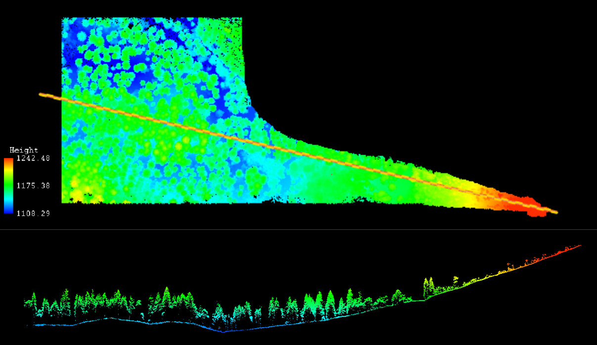
Lidar data on board one of our UAVs was acquired in the last field campaign early July for mapping forest structure in an alpine valley. The data delivered very good and interesting vertical information about the vegetation structure and the terrain of this study site. However, the actual UAV flight was very challenging due to the narrow valley, no/bad GPS reception and hardly a suitable launch/landing site. Nevertheless we managed to carry the UAV up the mountain and flew a few times before the weather conditions changed. We are very much looking forward to the next analysis with UAV Lidar, airborne Lidar, radar and multispectral plus various in-situ data sets.

further details on the webpage:
uav.remote-sensing.org

follow us and share it on:

you may also like:

EAGLE social ski retreat

EAGLE social ski retreat

To recharge their batteries after an intense semester, some EAGLE students went skiing together in the Austrian Alps, taking the opportunity to experience cold-region environments themselves. Beyond the thrill of the slopes, the trip allowed students to observe snow...

PhD Opportunity in Drone-Based Snow Monitoring

PhD Opportunity in Drone-Based Snow Monitoring

A new PhD position in Drone-based Terrestrial Snow Monitoring is currently open on Svalbard, offering an exciting opportunity to work on Arctic remote sensing research. Based in Longyearbyen, Svalbard, with Larissa Beumer the position focuses on advancing...

Share This