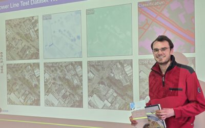
As part of the EAGLE M.Sc. programme, our international students attended this winter term the Urban Earth Observation lecture by EORC professor Hannes Taubenböck. The session offered a comprehensive overview of how remote sensing has evolved into a central tool for analysing urban systems — not only as built environments, but as complex socio-ecological spaces shaped by climate, health, and human behaviour.
Cities are expanding at an unprecedented rate, and with that growth come challenges related to heat stress, air quality, infrastructure pressure, and public health. Hannes Taubenböck emphasised that Earth observation allows us to observe urban areas consistently across space and time, making it possible to move beyond isolated case studies toward global, comparable urban analytics.
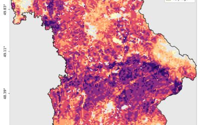
A key theme of the lecture was the connection between urban form and urban climate. Satellite-derived land surface temperature, vegetation indices, and surface material classifications help identify heat islands, cooling effects of green infrastructure, and spatial inequalities in exposure to environmental stress. Such information is increasingly relevant for climate adaptation strategies and urban planning. The ability to monitor these dynamics at city scale supports evidence-based decision-making, particularly in rapidly growing metropolitan regions.
The lecture also addressed urban health, highlighting how remote sensing can serve as a proxy for environmental risk factors. Spatial patterns of density, accessibility to green space, and pollution exposure can be derived from Earth observation data and linked to epidemiological indicators. While remote sensing does not replace ground-based health data, it provides a critical spatial framework for understanding environmental determinants of well-being.
From a methodological perspective, students were introduced to a broad spectrum of remote sensing techniques and algorithms used in urban research. These included:
-
Multi-sensor data fusion combining optical, radar, and thermal imagery
-
Machine learning and deep learning approaches for urban classification
-
Morphological and texture-based analysis for built-up structure detection
-
Time-series analysis for monitoring urban growth and transformation
-
3D urban modelling using stereo imagery and LiDAR
-
Semantic segmentation for mapping urban functions and land use
The discussion highlighted how algorithmic advances — particularly in AI-driven image analysis — have enabled higher thematic detail and automation, making large-scale urban mapping more feasible than ever before.
Importantly, Hannes Taubenböck framed these methods within practical applications. Remote sensing supports disaster risk assessment, informal settlement mapping, infrastructure monitoring, and sustainable urban development planning. It also contributes to policy frameworks such as the UN Sustainable Development Goals by providing measurable urban indicators. Students were encouraged to view Earth observation not only as a technical discipline, but as an interface between science, governance, and society.
For the EAGLE students, the lecture reinforced how interdisciplinary urban research has become. Understanding cities today requires integrating geospatial analytics with climate science, social data, and planning perspectives. Remote sensing offers a unique vantage point: it reveals patterns invisible from the ground, yet directly relevant to everyday urban life.
The session also offered space for open discussion on future directions — from higher-resolution satellite constellations to ethical questions surrounding urban data. As cities continue to grow and transform, the ability to observe them responsibly and intelligently will remain a central challenge for the next generation of geoscientists.