We are glad to announce our next presentation within the Workshop Report Series at the Earth observation Research Hub. On the 9th of November, Sofia Garcia et al. will talk about “Detection and classification of urban trees using remote sensing and AI“.
Abstract
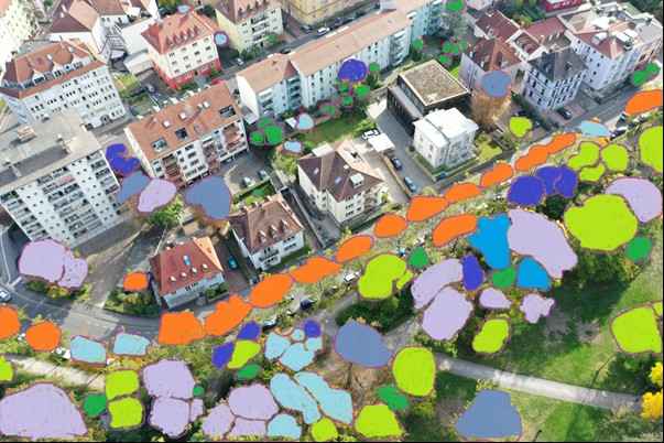
Detailed, reliable, and reproducible data on urban trees in private and public spaces is critical for an accurate understanding of their contribution to ecosystem services. Nevertheless, collecting data for single trees in heterogenous environments still entails several challenges for satellite-based remote sensing approaches. In this study, we focus on characterizing and classifying trees in Munich and Würzburg using a multi-temporal analysis for exploring key pheno-phases of the different species. We also compare the capabilities of two data sets – Worldview and PlanetScope- and apply a pattern-based accuracy assessment. This presentation shows the outline of the project, a proof-of-concept of the multi-temporal analysis, and opens the space to discuss the most significant challenges of the proposed method.
Title of presentation: Detection and classification of urban trees using remote sensing and AI Authors: Sofia Garcia (Institute for Geography and Geology, Julius-Maximilians-Universität Würzburg, Würzburg, Germany; presenter), Tobias Leichtle (German Aerospace Center (DLR), Wessling, Germany), Hannes Taubenböck (Urban Remote Sensing, Institute for Geography and Geology, Julius-Maximilians-Universität Würzburg, Würzburg, Germany; German Aerospace Center (DLR), Wessling, Germany), Thomas Rötzer (Forest Growth and Yield Science, School of Life Sciences, Technical University of Munich, Freising, Germany), Klaus Martin (Company for Remote Sensing and Environmental Research (SLU), Munich, Germany), Date: Wednesday, 9th of November, 2022 Time: 10 – 11 a.m. (GMT+1h) Place: Online Presentation language: English Slides: English

