The M.Sc thesis by Marius Röder (Hochschule für Technik Stuttgart) was handed in. The thesis was supervised by Dr. Hooman Latifi and Prof. Eberhard Gülch and focuses on monitoring post-disturbed and heterogenuous forest sites by cost-effective methods from Unmaned Aerial Vehicle (UAV) domain. The advantage of normalized digital surface models extracted from UAV dta was initially compared to the products derived from standard aerial photography. Subsequently, the suitability of UAV-based inventory was compared to traditional eld methods . For this purpose, reference and UAV data were compared in terms of quality, quantity and cost eectiveness. In addition, an algorithm for automatic tree detection was compared to the manual detection on the UAV-imagery. The extent to which the results differ for certain forest heterogeneity as well as for single and grouped tree individuals was addressed., followed by a cost and benefit analysis of UAV-based forest inventory compared to traditional field-based methods.
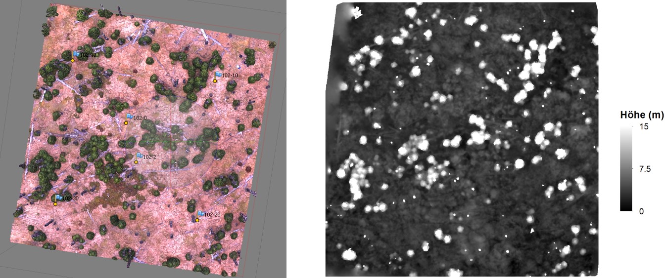
UAV-based point cloud (left) and UAV-based nDSM (right) of an examplified sample plot in Bavarian Forest National Park
the results showed that the UAV inventory can not fully replace the eld methods in terms of quality and quantity due to the general disadvantages of photogrammetric methods in the small-scale forest sites consisting of dense rejuvenation stocks. However, from a purely economic point of view, the advantages over the eld method predominate. Improvements could be achieved by combining field and UAV-methods or a simulteanous use of digital camera and laser scanner mounted on UAV.