UAS data acquisition in Würzburg city

UAS data acquisition in Würzburg city

November 8, 2022

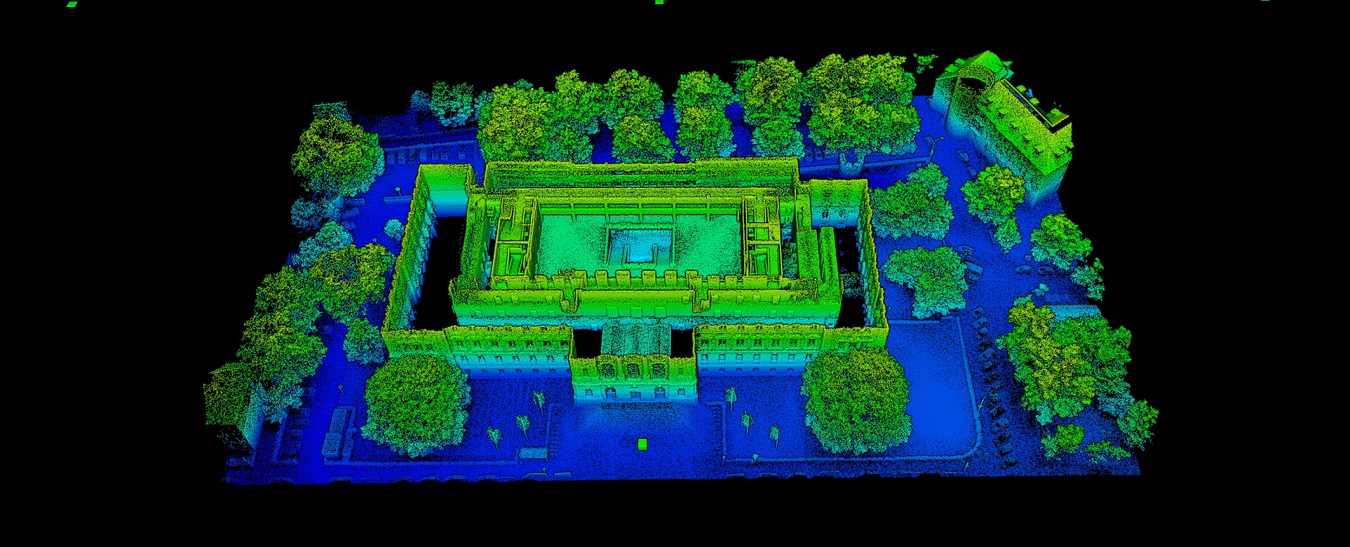
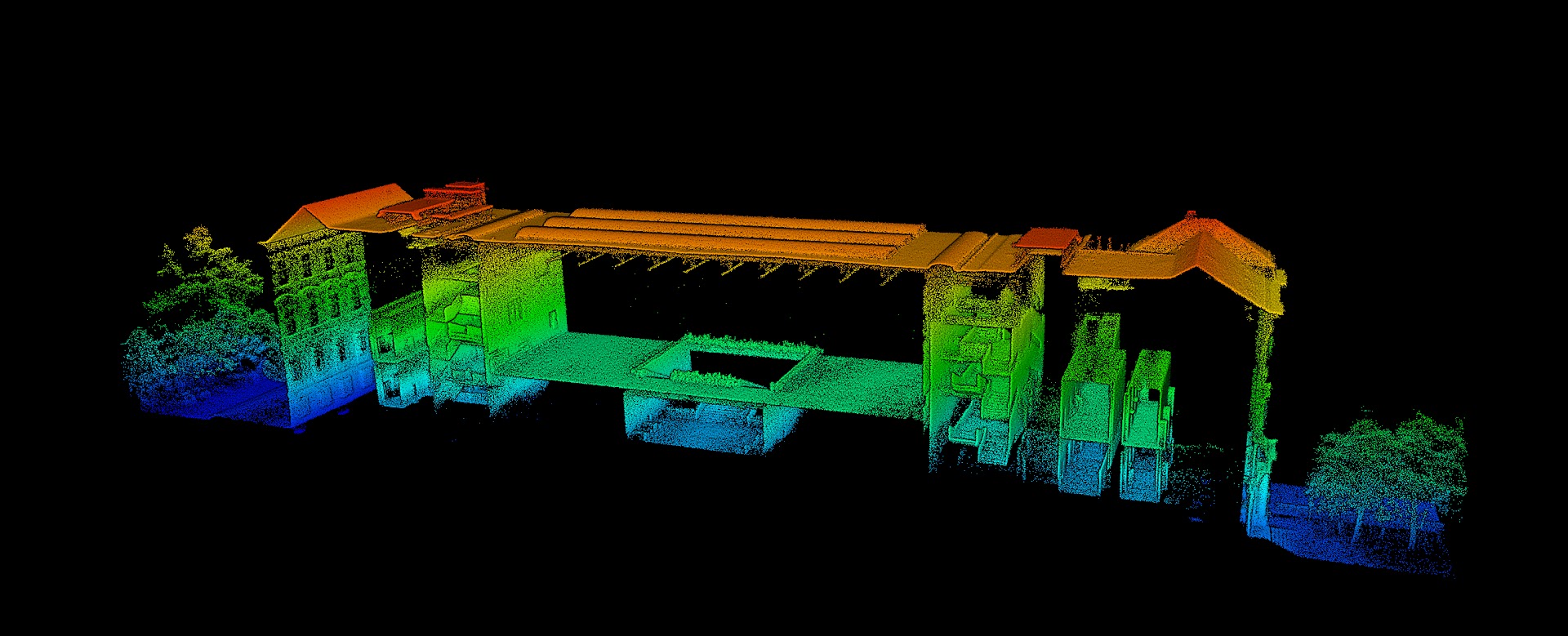
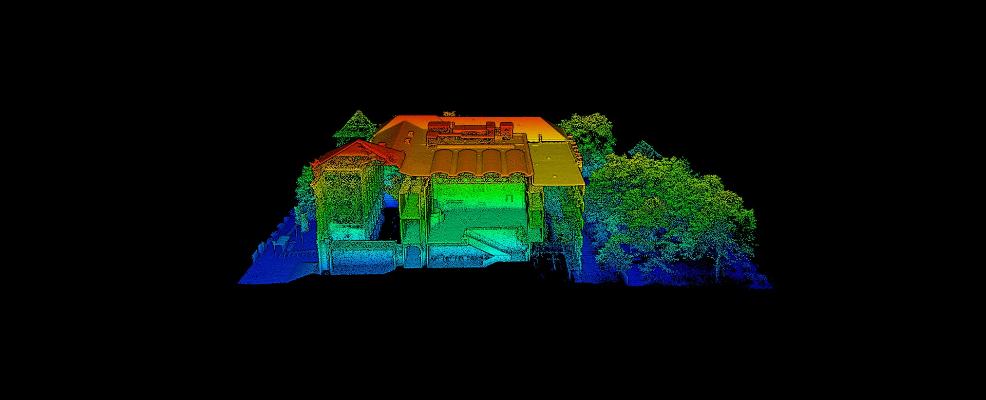
For a small part of the city of Würzburg covering buildings and city trees Lidar (ALS, TLS), thermal and multispectral UAS-based data was acquired, lead by Dr. Mirjana Bevanda and our colleagues Antonio Castaneda and Jakob Schwalb-Willmann with the help of many staff member of our Research Hub.

The data acquisition took a whole day with various launches and different sensors and was managed with different UAS pilots in different positions and various helping hands for managing safety issues, spontaneous visitors and interested public. The results are quite impressive and will be used for future urban research ranging from urban canyons and heat islands up to urban trees and forest.

you may also like:

Poster Presentation at AK Hydrologie, Bonn

Poster Presentation at AK Hydrologie, Bonn

From November 13 to 15, Sofia Haag and Christian Schäfer attended the AK Hydrologie workshop in Bonn, where they presented their work from the EO4CAM project. The first day featured an insightful field excursion to the Ahrtal region, led by Prof. Dr. Jürgen Herget,...

A Glimpse into Our Research: Data on Display in the Foyer

A Glimpse into Our Research: Data on Display in the Foyer

Stepping into the foyer, visitors are now greeted by large, striking images that tell the story of our research through data. Each visual represents a unique scientific perspective – from the Arctic to the cultivated landscapes of Bavaria, and from forest canopies to...

Successful MSc defense by Sonja Maas

Successful MSc defense by Sonja Maas

Big congratulations to Sonja Maas, who successfully defended her Master thesis today on the highly relevant and increasingly pressing topic: LiDAR-Based Acquisition Strategies for Forest Management Planning in a Mature Beech Stand Supervised by Dr. Julian Fäth and...

Visit at the Institute for Geoinformatics (IFGI) at University of Münster

Visit at the Institute for Geoinformatics (IFGI) at University of Münster

Two days ago, our PostDoc Dr. Jakob Schwalb-Willmann visited the Institute for Geoinformatics at University of Münster to give a talk at IFGI’s GI Forum titled “Can animals be used to classify land use? Employing movement-tracked animals as environmental informants using deep learning”.