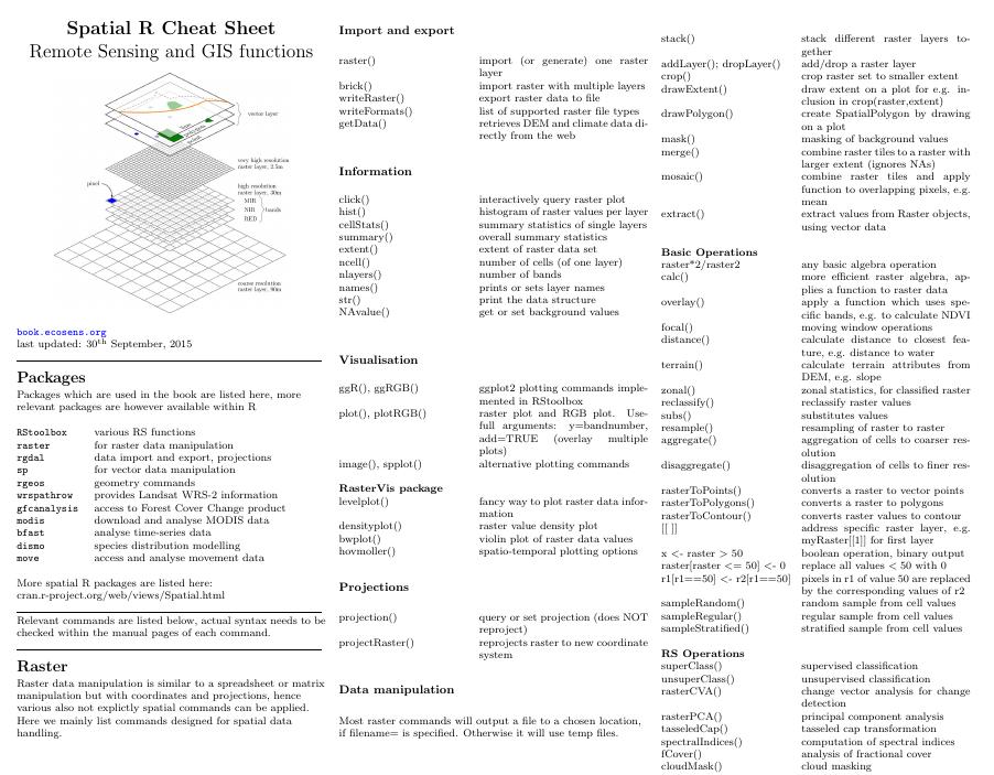
 We updated our cheatsheet on spatial data handling in R. Beside some minor changes of common raster commands we also added now some of the new RStoolbox commands within a Remote Sensing operations section such as the command for supervised classification, fractional cover analysis or cloud masking.
The R spatial data handling cheatsheet has been created to ease the use of relevant R commands and cen be downloaded as pdf.


