An update for rsMove is now available on CRAN. rsMove was designed to support movement ecologists in the selection and handling of remote sensing data. This package helps select study sites, guides the choice of satellite data by quantifying the influence of its spatial and temporal resolutions on movement data and quantifies species-environment interactions to help choose environment variables. Additionally, rsMove provides tools to homogenize the scales of remote sensing and animal movement data, select presence/absence samples and model resource suitability from a remote sensing perspective (see Remelgado et al., 2017). Most of the functions in rsMove are accompanied by ggplot objects providing the users with editable plots. This release significantly improves function descriptions and keywords. Moreover, we included a vignette with practical examples! To acces it, click here.

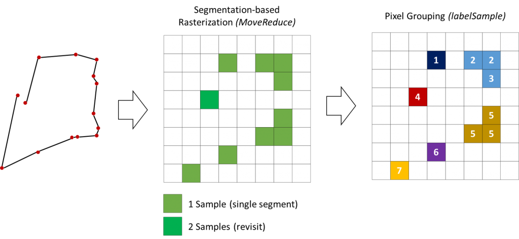
translation of movement data (on the left) to pixels that preserve revisits (center) – to adress pseudo-replication – and the subsequent split of training samples based on their connectivity (right) – to address spatial autocorrelation.

