
AgriSens DEMMIN 4.0 field work – mission completed

AgriSens DEMMIN 4.0 field work – mission completed

June 15, 2022

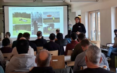
Last week some EAGLE students ventured out for a field campaign at the Durable Environmental Multidisciplinary Monitoring Information Network (DEMMIN) test site to support us in the field work for the AgriSens DEMMIN 4.0 project funded by the Federal Ministry of Food and Agriculture (FKZ: 28DE114D18). The site is located near the city of Demmin in Mecklenburg-Western Pomerania, and intensively used for agriculture.

EAGLEs had a closer look at the landscape formed during the Weichsel glaciation over 11,600 years ago. In particular, students conducted vegetation and soil property surveys on the winter wheat fields in wonderful sunny conditions.

In return to their support, they learned how to collect in-situ data with a variety of devices under the supervision of Dr. Sarah Schönbrodt-Stitt and Dr. Michael Thiel. In the context of agricultural applications for remote sensing, the relevance of phenological cycle, soil moisture, and biomass were extensively discussed. In addition, our UAV (DJI M600) was used to collect images with its multispectral sensor. EAGLEs have gained a valuable perspective on field information and planning in the scope of earth observation.

follow us and share it on:

you may also like:

Setting Up for the 2nd EO4CAM Nutzerworkshop

Setting Up for the 2nd EO4CAM Nutzerworkshop

Right now our staff are busy hauling cases, mounting displays and testing every cable for the 2nd EO4CAM Nutzerworkshop, “Erdbeobachtung für die Klimaanpassung, behördliche Akteure in Bayern”. The doors open tomorrow, and the exhibition...

A dashboard for multi-UAS thermal data

A dashboard for multi-UAS thermal data

Mapping an active fire with various drones flying in parallel is hard enough. But getting the data processed, evaluated and turned into research datasets is a different story. The publication is on its way, and for now we’d like to share a dashboard by Antonio José...

Have you ever wondered how many trees there are on our campus?

Have you ever wondered how many trees there are on our campus?

Sometimes a chat during a formal event like the one for the Urban:Pulse funding celebration, results in something totally different. Following a discussion with the vice-president of our University, we promised to look into the research by one of our PhD students...

Earth Observation at the DFG BETAFOR workshop

Earth Observation at the DFG BETAFOR workshop

Jakob Schwalb-Willmann represented our team at the DFG BETAFOR workshop in the Bavarian Forest National Park. The room was full of biologists, which is the whole point of an interdisciplinary project, and our UAS multisensor time series drew a lot of interest from the...

Thermal Drone Data Acquisitions: CalVal project with Informatics

Thermal Drone Data Acquisitions: CalVal project with Informatics

Thermal cameras on drones look very good - visually. They show us temperature of our study objects be it stressed trees, warm patches in a city or active fires. But we do not yet know for sure how far we can trust the temperature values they deliver especially when...

bzgl. Art. 50 Verordnung (EU) 2024/1689 (AI Act):

Überwiegend werden eigene originäre Texte und Bilder des EORC genutzt, jedoch sind einige Inhalte von blog post Texten teilweise mit Hilfe von KI überarbeitet worden und einige Bilder sind ganz mit KI erstellt, die jedoch deutlich keine photorealistische Darstellungen abbilden. Aussnahmen sind KI generierte fernerkundliche Datensätze, die explizit für Forschungszwecke mit KI erstellt wurden, hier wird aber durch den assoziierten Text der wissenschaftliche Grund der KI generierten Bilder erläutert.

Share This